New York Harbour
Tide and Current Monitoring for Navigation and Maintenance
The greatest of the Coast Survey mid-nineteenth century harbour studies was that of New York Harbour. In 1855, the Commissioners on Harbor Encroachments of New York requested that new hydrographic surveys of New York Harbour be conducted. The first surveys had been conducted twenty years earlier and considerable changes had occurred.
Following the completion of the new hydrographic surveys of New York Harbour, an advisory council, consisting of Coast Survey Superintendent Alexander Dallas Bache, General Joseph Totten, and Commander Charles Henry Davis, produced a report for the Commissioners detailing the changes that had occurred. They also recommended a physical survey of the harbour be conducted to determine the causes of the changes. They recognised that “… when it comes to those of improvement nothing less than a physical survey will answer. A few thousand dollars thus expended, by determining the minute actions of the tides and currents and their causes, may save hundreds of thousands in expensive tentative works of improvement.”
The council’s report noted extensive changes. Between the Hudson and East Rivers alone, 1,220 acres of land had been made “upon which, formerly, the tide rose more than four and a half feet, removing thus a tidal space of nearly nine millions of cubic yards from this part of the harbour.” Although many of the changes were beneficial, in many instances harm had been done to local channels and commercial areas. The nature of the problem as described by the council was: “It is not sufficient to know the changes and their extent. The causes which have produced them must be ascertained. In this way alone can they be regulated and controlled …. We cannot too often repeat, that whatever changes the direction and velocity of the current, must change the regimen of the harbour for good or evil.” The council went on to suggest that New York Harbour would have been better off “had the shore-line been regulated years ago according to a systematic plan.”
Recognising that the force behind the encroachments on the harbour was the high value of real estate, the council blunted potential charges that they were against private property rights by advocating use of an additional 1,840 acres for dock space and the filling-in of 2,840 acres of tidelands amounting to 34,000,000 cubic yards of harbour volume. But, this was to be “done according to systematic plan, which will avoid the dangers we have observed or have been able to foresee…”
Contained within the New York Harbour report is the concept of finite resources and the need to conserve economic resources. The council recognised that: “New York Harbour, like all other tidal harbours, must principally depend on the ebb and flood to keep its approaches and channels in navigable condition. For this reason it is necessary to preserve jealously, the water area of the harbour, so as to permit the greatest possible quantity of tide-water to enter it and by its efflux to scour the channel and bar.”
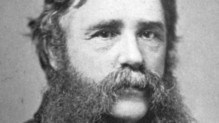
As a result of the report, the state legislature of New York requested that the Coast Survey “complete the physical survey of the harbour, so that the results might not only be adapted to purposes of navigation but to the study of the changes in progress.” Accordingly, Bache assigned Assistant Henry Mitchell to the physical survey. Mitchell had just finished a major study of the tides and currents of Nantucket and Vineyard Sounds and had worked part of the past year conducting tidal observations in support of hydrographic surveys in New York Harbour. He differentiated between studying tides and currents for purposes of navigation and for studies of harbour improvements and realised that:
“The study of tides and currents must be regarded in a two-fold relation: first, as affording the means of constructing prediction tables for immediate use in navigation; second, as an inquiry into a class of agencies whose ceaseless activities are gradually altering the configuration of our harbors and seacoasts ….“
Working from shore stations and the Coast Survey Schooner Madison in the Hell Gate area in 1857, Mitchell established self-registering tide gauges and two manually observed box gauges. The box gauges were observed every 15 minutes, night and day, during the course of the survey. Showing an increased level of sophistication over earlier tidal surveys, he connected the permanent stations “by lines of levels, so that we are able to refer all the observed heights to a common zero and ascertain the disturbance of sea level at each stage ....” He also noted that “The changes in the mean water level, caused by long continued gales of wind, are among the most striking characteristics of this region….”
The Madison occupied long-term stations and its boats were employed in locations where a single day’s work would suffice. Observations were made in the axis of the stream; and, by judicious use of the boats, as many points as possible were occupied simultaneously. The primary instrument for observing currents was the ‘ordinary log’, a weighted pole with a graduated line used to measure the velocity of the current. Velocities and directions of currents were recorded at half hour intervals while on station, as well as the time of slack water. Most of the major stations were occupied with an unbroken series of observations for 7 to 9 days.
Within New York Harbour, it would seem that the work would not be dangerous. However, Mitchell considered the difficulties in the Hell’s Gate area to be “almost insurmountable” particularly in observing maximum flood currents off Hallet’s Point. At this locality “the flood streams are gathered together into a single torrent, in which no boat can lie at anchor. We repeatedly tried ... to secure a boat in this place during the flood current, and in each case it was either run over by drifting vessels or by the stream itself.” Mitchell abandoned the use of boats in this area and then attempted using “free floats and noting the time of their passage across certain ranges.” However, as each float tended to follow a different path, this method was a failure. In spite of this, Mitchell succeeded in examining “the whirls and counter currents in the vicinity of Hell Gate....” and discovered that, “Many of the more remarkable of these are confined to fixed limits, and regularly recur with each ebb or flood current.”
In 1858, Bache instructed Mitchell to study both surface currents and “the motions of the waters below.” The goal of studying the sub-surface regime was to define the factors affecting sedimentation and erosion in the tidal basin. Mitchell invented an “ingenious apparatus” to observe the sub-surface currents. This device consisted “of two large copper globes, as floats, connected by a slender cord, one weighted so as to float when immersed to the depth of four feet, and the other so as to sink to different depths in the currents which it may be desired to investigate. The motion of the apparatus will depend, of course, upon the difference of movement at four feet, the nearly superficial current, and below…”
By means of his floating copper globes, Mitchell “ascertained that, instead of uniform gradation of velocities from surface to bottom, there often occurs in deep channels a counter drift, or even distinct streams, at different depths. …. At some of our stations phenomena of this character never fail to repeat themselves daily, on the recurrence of certain tidal phases….” Mitchell’s discoveries were totally unexpected; and, if not unprecedented, certainly were among the earliest to determine the nature of the movement of water masses in estuarine environments.
In spite of Mitchell’s studies and the exhortations of the advisory council, mindless practices continued to dominate the use of New York Harbour. Unauthorised filling of wetlands was commonplace as was the extension of construction beyond the lines allowed by law. These were not only the acts of private citizens but were also done under the authority of the city government.
Sewage was also a source of damage to the harbour. In the mid-nineteenth century there were few concerns with public health or damage to the environment. However, there was great concern with the potential commercial damage to New York Harbour. Sewage filled the slips in the harbour at “nearly eighteen inches each year” and that out of one hundred and ten sewer outlets, only four discharged at the outer end of the piers with the rest discharging into the still waters of the slips or basins where sewage accumulated.
Paralleling the sewage problem was the dumping of street cleaning dirt into the waters of the harbour which also filled up the slips, from the practice of heaping it up on the piers and bulkheads. At least one pier gave way from the accumulation of dirt upon it, and 3,000 cart loads (approximately 3,000 tons) were dumped in the river. Considering that much of the ‘dirt’ was horse manure, it takes little imagination to visualise what a cesspool New York Harbour must have been.
To remedy the evils affecting the capacity of the harbour, the Commissioners requested that the legislature of New York enact stiffer penalties for encroachments and the power to remove the encroachments at the cost of the offending parties. Concerning the sewage and dirt, “All new sewers should be carried to the outer ends of the piers ... and, where practicable, the termination of those now built should be changed so as to empty in like manner with the new ones.... No dumping should be permitted upon or near the piers or bulkheads, under a penalty; and the city inspectors should be required to have scows or other vessels provided and ready to receive the dirt from the carts, there being no good reason why dirt should have a preference over all other articles in the use of our piers and bulkheads.”
Change and encroachments continued. Henry Mitchell conducted major studies of New York Harbour again in 1866-67, 1872-1873, 1876, 1880, and 1887. Following the initial physical survey of the harbour, a flurry of similar studies were undertaken at Boston Harbour, Mobile Harbour, and the site of a proposed canal between Cape Cod Bay and Buzzards Bay, Massachusetts. The object of these surveys was generally the preservation of the waterways “by preventing dangerous encroachments on the water in the rapid progress of buildings and of improvements on land, by ascertaining the changes caused in the water space by the changes in the land, and the causes of these changes.” These pioneering studies were landmarks in both conservation and estuarine science and, although the technology and methods have changed, still serve as models for similar studies and policy decisions today.

Value staying current with hydrography?
Stay on the map with our expertly curated newsletters.
We provide educational insights, industry updates, and inspiring stories from the world of hydrography to help you learn, grow, and navigate your field with confidence. Don't miss out - subscribe today and ensure you're always informed, educated, and inspired by the latest in hydrographic technology and research.
Choose your newsletter(s)


