Physical Oceanographic Real-time System
Real-time Data Improve Safety, Spur the Economy and Benefit the Environment
Physical Oceanographic Real-Time System (PORTS) is a growing programme providing a range of navigation safety, economic and natural resource protection benefits. The programme is managed by the National Ocean Service (NOS), part of the National Oceanic and Atmospheric Administration. The NOS are responsible for providing oceanographic data and other navigation products in order to promote safe and efficient navigation within US waters. Here we discuss the proven benefits of PORTS and elements required to ensure delivery of high-quality real-time data.<P>
View Larger Map
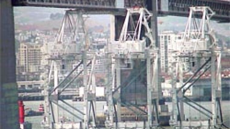
Since maritime commerce has tripled in the last 50 years in US waters, there is a growing need for real-time oceanographic data products. Ships are also growing in size, including deeper draft vessels that test the channel depth limits and the bridge clearance within many harbours (Figures 1 and 2). More than 95% of US international trade is moved through ports and harbours, and more than 50% of the goods are considered hazardous. The challenge therefore exists to move cargo efficiently while reducing risks to life, cargo and the environment.
Customised Service
PORTS supports safe and cost-efficient navigation by providing shipmasters and mariners with accurate real-time information (website 1). Specifically, PORTS provides data related to tide level, water depth, current speed and direction, air gap (distance between the water surface and the bottom of a bridge), wind speed and direction. To help improve estimates of volumetric cargo loadings, data on water temperature and salinity are also provided. These data are updated on the internet every 6 minutes, and the information is available over the telephone in select ports and harbours.
Data are available in a variety of formats including online composite displays. Graphical displays were designed with the stakeholder interests in mind. Figure 3 illustrates an example composite display combining a full suite of measurement parameters on one user-friendly graphic. Users also have the ability to build their own customised page by selecting and dragging individual plots from one or more PORTS to a position on the page. Once the page is constructed, it can be saved, bookmarked and shared with others. Users can build as many customised pages as required (website 2).
In Operation
Sensors are mounted on a variety of platforms, including shore-side facilities, pilings and existing aids to navigation (ATON). Figure 4 illustrates an example of a horizontal acoustic Doppler current profiler mounting system. Based upon experience at various locations, and the need to develop repeatable and reliable hardware components, mounting systems have been designed and optimised specifically for PORTS. One example is a ‘clamparatus'; a device allowing current meters to be installed on standard US Coast Guard (USCG) ATON buoys (Figure 5).
At present, there are 18 PORTS systems in operation along the Atlantic, Gulf and Pacific Coasts as well as in the Great Lakes region (more are under construction at the time of writing). These systems span about 50 ports and harbours. Some systems are relatively small, such as the Port of Anchorage where there are two sites (Nikiski and Anchorage). Other systems are larger in scale, such as at Chesapeake Bay where there are 38 stations. In most installations, each station can also contain multiple sensors. For instance, the Yorktown USCG Training Center on the Lower Chesapeake measures water level, wind speed and direction, air and water temperature, atmospheric pressure and water conductivity (salinity). Data requirements are specified by the local stakeholders and user community.
Programme's Benefits
Shipmasters use PORTS information to improve shipping safety by avoiding groundings and collisions. The data also provide the maritime industry with highly accurate information to optimise the business of shipping. In addition to improving the safety and economy associated with shipping operations, PORTS data are also valuable for:
- aiding environmental response and clean-up efforts for spills or other accidents
- assisting with search and rescue missions
- improving homeland security
- improving engineering design of water-based projects
- planning wetland restoration projects
- assisting recreational users of waterways (for example, sailing, fishing, etc.) plan activities
- supporting scientific research and education.
Economic benefits are realised in the form of avoided groundings, increased draft/reduced lightering for inbound cargo, reduced delays for commercial vessels, improved spill response, reduced distress cases for recreational boats, and improved weather and storm surge forecasts. Other benefits include enhanced recreational opportunities, and educational and scientific/engineering applications.
PORTS has proven to be a solid investment. Studies authored by the Woods Hole Oceanographic Institute Marine Policy Center have shown a positive benefit-to-cost ratio associated with PORTS. For example, in Tampa (FL, USA) the annual realised quantifiable benefit is USD4.4-7.0 million. A similar study estimated the annual quantifiable enefit from Houston/Galveston PORTS data to be USD14.1-15.6 million.
Required Elements
Successful operation of PORTS is strongly dependent upon the following elements.
Quality assurance/quality control (QC/QA) of data: the National Oceanic and Atmospheric Administration (NOAA) maintains a Continuous Operational Real-Time Monitoring System (CORMS), an operation within NOS' Center for Operational Oceanographic Products and Services (CO-OPS). QA/QC activities operate on a 24/7 basis, comprising automated systems along with experienced CORMS operators working 12-hour shifts. Should a problem be discovered, CORMS, QA oceanographers and field personnel work together to resolve the situation.
Rigorous instrument testing protocols: all instruments and components must meet stringent performance, accuracy and reliability requirements before being eligible for field deployments.
Regular operations and maintenance, and documentation: a standard operations and maintenance schedule must be adhered to, along with strict documentation of system maintenance, repairs and performance.
Local partnerships/sponsors: PORTS is a unique partnership between the federal government and local stakeholders (for example, port authorities, pilots, local environmental agencies and other members of the local maritime community).
Future Plans
Approximately one-third of the ports and harbours within the USA currently have an operational PORTS. There is a vision for PORTS in more than 150 ports and harbours nationwide. The growth will depend upon local stakeholder interest and funding, as well as potentially increased federal support for the programme. In addition to geographic growth, new sensors may also be incorporated into PORTS depending upon technology, approved testing and user needs. Some examples may include visibility sensors and wave-measuring devices. The NOAA is also working with the USCG to transmit PORTS data over the automatic identification system (AIS), a vessel tracking system. Vessels will not only have access to other vessel positions but also environmental data. Additionally, PORTS® is being leveraged with existing data collection programmes such as the National Water Level Observation Network (NWLON). Together with other existing operational oceanography programmes, PORTS data management and QA/QC infrastructure provides a scalable backbone for larger scale initiatives; for example, the Integrated Ocean Observing System (the US portion of the Global Ocean Observation System, GOOS).
Further Reading
Kite-Powell, H., 2005. Estimating Economic Benefits from NOAA PORTS Information: A Case Study of Tampa Bay. Tampa Bay Harbor Safety & Security Committee, Tampa, FL.
Kite-Powell, H., 2007. Estimating Economic Benefits from NOAA PORTS Information: A Case Study of Houston/Galveston. Port of Houston Authority, Houston, TX.

Value staying current with hydrography?
Stay on the map with our expertly curated newsletters.
We provide educational insights, industry updates, and inspiring stories from the world of hydrography to help you learn, grow, and navigate your field with confidence. Don't miss out - subscribe today and ensure you're always informed, educated, and inspired by the latest in hydrographic technology and research.
Choose your newsletter(s)


