Real Time Point Cloud for Multibeam and Topo Laser Surveys
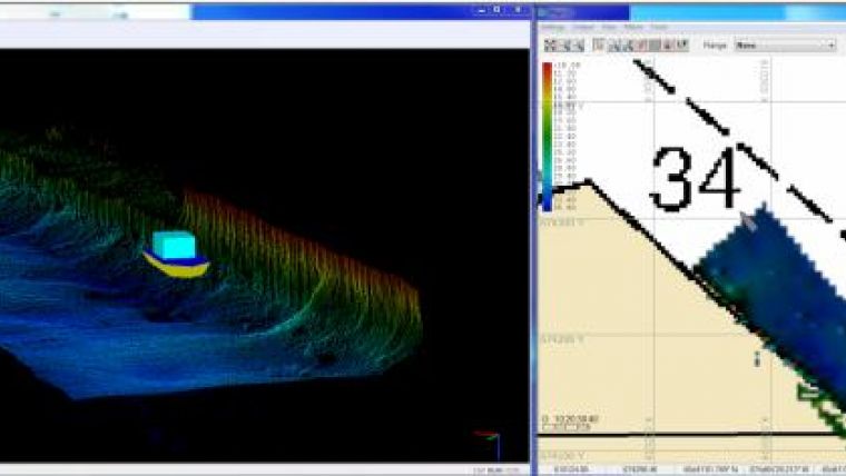
US-based HYPACK has released its Real Time Point Cloud. This release is an upgrade to the HYPACK2014 release. The application runs in conjunction with HYSWEEP SURVEY and displays both multibeam and topographic laser data in a corrected and geo-referenced colour-coded point cloud.
Real Time Point Cloud is developed to be useful for easier feature detection and categorisation, system calibration and verification, and data quality control. This program enhances the already powerful multibeam and topographic laser collection capabilities of HYSWEEP®.
The application can provide for real time QC on overlapping swaths and keeps track of the last 3,000,000 data points and displays them in a cloud. Depending on ping rates and swath sizes, it can display over an hour of multibeam data on the fly.
Real Time Point Cloud allows capture and export of geo-referenced images to BMPs and it includes 3-axis rotations and zoom in-out real time tools. As a separate core processor is used, the efficiency of HYSWEEP® SURVEY is not affected. The application runs in both 32-bit and 64-bit computers to accommodate everyone.
This program will be available for download at www.hypack.com support site from 1 June2014. The upgrade to the HYPACK 2014 release is provided free of charge to all HYPACK/HYSWEEP users only.
Image: HYPACK Real Time Point Cloud (left) and HYPACK Survey (right).


