Satellite-based Radar Imagery in Europe
From 21 to 25 January 2008, the 2nd International SAR oceanography workshop SEASAR-2008 was held in the ERS research institute ESRIN of the European Space Agency on the perspectives of SAR imagery of oceans from space. The workshop was attended by 150 participants from 25 countries from Europe, America and Asia, including Russia - from international Nansen Center (St. Petersburg), ScanEx R&D Center and Space Research Institute of Russian Academy of Sciences.
ESA Director of Earth Observation (D/EOP) Volker Liebig opened the workshop, announcing that Europe plans to put into orbit 16 new different Earth observation satellites within the nearest future and that RS sector holds the second position now in the ESA budget in size of financing after launch funds.
ESA representatives declared that ERS-2 radar satellite operation had been extended for 3 more years from 2008 till 2011. Notably, this 12-year old veteran was launched back in 1995 and initially was scheduled to run for three years only. ESA leaders prepare to extend the lifespan for the other effective satellite ENVISAT-1 for 3 more years (2010-2013).
Plans for the manufacturing of the prospective Sentinel-1 radar satellite with 7-year service life have been also approved. Most important specification requirements for such satellite design are to provide services to sea navigation, Earth observation and emergency tasking for disaster areas with NRT delivery of images to end-clients (within 1 hour after imaging). The satellite is scheduled to be launched in 2011. The decision was also made to allocate funds to the construction of the second satellite, thus enabling to deliver radar images within the next 20 years.
Representatives from the Italian Space Agency ASI took the floor during the workshop announcing the COSMO SkyMed project status, whereas Canadian CSA and German DLR reps reported about the possibilities of their RADARSAT-2 and TerraSAR-X satellites respectively. The CSA agency representative said that the widely-commented in mass media bargain on selling RADARSAT data marketing rights to the USA had not yet been approved and was being negotiated. One of the negotiation issues is the fulfillment of the already signed reseller agreements.
The workshop was split into five basic sessions: Oil spills and ship detection, Ocean wind and current applications, Wave applications, internal waves and swell, Wave mode processing algorithms, validation and assimilation and Ice applications.
Most attention was drawn to the detection of oil slicks and ships detection issues. The EU directive ¹2005/35/ÅÑ that came into force as of March 1, 2007, imposes penalties for water area pollution due to ship wastes. Therefore, the reporting European specialists boldly operated with such terms as "illegal polluted water wastes".
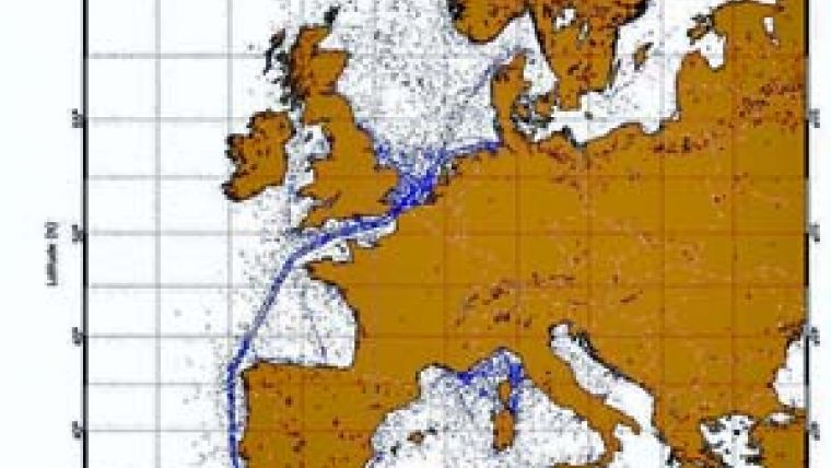
European Maritime Safety Agency (EMSA), following the requirements of the new directive, presented an implementation tool - on-line service of operational radar monitoring of offshore zones CleanSeaNet that was put into operation in March 2007. There are already 23 European countries that are clients of CleanSeaNet information services. All seas, including the Baltic and Black Seas, are covered by the monitoring system.
Under the contract with EMSA, RADARSAT-1 and ENVISAT-1 data reception is done by two ground stations in Italy and Norway, whereas starting in 2008 the third station in Portugal will be put into operation. In the new service the data on detected slicks is supplied via the web-access to the respective public agencies (coast guard, fishery agency, ecological monitoring, etc.) with a delay of 30 minutes after imaging at the most. The customers receive notification messages via all available communication means, including e-mail and sms-service, prior to the occasion.
If required, relevant agencies send patrol air planes and boats to verify the data, acquired using space images and to detect the pollution source. Satellite-based images, together with AIS and VMS systems data and radar coastguard monitoring data, are used as the ground for claims and prosecutions.
According to EMSA, 1520 images from ENVISAT-1 and RADARSAT-1 were processed, 1732 slicks were detected, 476 inspections were held and 144 oil dumping cases were confirmed in 2007. Joint use of satellite-based and aviation assets of monitoring turns out to be very cost-effective, considering the fact that airplane flights cost several thousand euros per hour in Europe.
CleanSeaNet service will be enriched soon with new information resources - ALOS, COSMO and TerraSAR-X satellites radar data, and there are plans to introduce software solutions to correlate ship routes and slicks movements on the water surfaces for a more correct identification of the pollution sources.
A representative of the Brazilian R&D Institute took the floor at the workshop with the report on modeling ocean current in the areas of offshore oil production by Petrobraz company, which funds this research work. This biggest Brazilian oil producing public corporation received severe sanctions in the past for major accidents resulting in Rio-de-Janeiro Bay pollutions. In Russia, only Lukoil company uses radar imagery largely to monitor the water areas in the Baltic and Caspian seas. The fact that space technology is not interesting for other companies, operating in Russian offshore zones (including foreign companies), only testifies to excessive liberality of our legislation in issues of water area pollution control.
Most attention of presentations in the session dedicated to ship detection and navigation was drawn to the development of algorithms of integration of space data with other observations systems (AIS and VMS systems) and port area coastal control systems. Despite ship and ship wastes detection is still a probabilistic problem, processing models and algorithms improvement is ongoing, number of satellites is increasing, enabling to increase the revisit periods for water areas. As a result, the specialists believe that in 3-5 years from now the on-line services to monitor ship navigation through Europe using SAR imagery will start to operate. Notably, Google Earth/Maps geoportals are already used as software platforms for visualization and data exchange by many agencies and services.
The workshop became not only a traditional place for information exchange between representatives of science, governmental agencies and business, but the body, authorized to generate recommendations and to define directions of further research work. The new ENVISAT-1/ASAR Level-2 standard product was introduced at the workshop - the 2D Doppler wave spectra, enabling to define properties of ocean currents. The end product is the result of Wide Swath imagery data processing at the ENVISAT-1 data reception ground station upgraded in summer 2007.
French IFREMER institute, Nansen Center and Boost Technologies company specialists demonstrated also the results of other ENVISAT-1/ASAR standard product processing - images of waves in global scale, made to detect long ocean waves. Despite participation of Russian specialists in joint research studies with ESA, we have to admit Russia is lagging far behind in the issues of creating information services based on near-real time radar satellite monitoring.
The presented on the workshop service of operational radar monitoring of oil wastes with on-line access, supported by a group of agencies together with ScanEx R&D Center, covers today only the northern part of the Caspian Sea. At the same time, the technology has already been created to expand monitoring limits.
There are no domestic SAR satellites currently operating, whereas the onboard SAR sensor components are not allowed to be purchased from abroad due to some pseudo-patriotic sentiments. As a result, Russian water areas are still open for unregulated discharge and pollution, smuggling, poaching, illegal traffic and fishing.


