The Amphibious Engineers in World War II
Part I - New Guinea
On 21 March 1942, General Douglas MacArthur had just escaped from conquering Japanese forces that had overrun the Philippine Islands. In a speech that day he vowed “… I shall return.” A major part of that return involved the formation of Engineer Special Brigades (ESBs) with their attached Engineer Boat and Shore Regiments (EBSRs). These Army Corps of Engineers units were a specialised group of hybrid soldier-sailors. Their mission was to transport men and equipment in shore to shore operations, construct pier and dock facilities, roads and landing strips. These brigades were composed of 360 officers, 7500 enlisted men and 550 landing craft – 36-foot LCVPs (Landing Craft Vehicles and Personnel) and 50-foot LCMs (Landing Craft Mechanised).
The development of these units began on 20 May 1942, with the activation of the Army amphibious training command at Camp Edwards, Massachusetts. As the army had little small-boat experience and less navigation experience at this time, training for these critical skills was done by Coast and Geodetic Survey officers on loan to the Army. Commander Leo Wilder, C&GS, was head of boat operation instruction and Commander Clarence Burmister, C&GS, was head of the navigation school. Burmister was cited for being “particularly outstanding in developing navigation aids which later proved highly successful in the prosecution of a new and effective type of amphibious warfare.” In addition, a number of C&GS officers were assigned to ESBs as regimental navigators, hydrographers and nautical experts on staff to various brigade headquarter units.
Following training at Camp Edwards, the EBSRs proceeded on to Carrabelle, Florida and/or Fort Ord, California for further training until shipped overseas. Although the EBSRs operated in both the European and Pacific Theaters of Operation, this article will concentrate on Douglas MacArthur’s stepping-stone offensive against the Japanese beginning with the retaking of New Guinea. While the Navy and Marines were assaulting the Gilbert and Marshall Islands, MacArthur was mounting a parallel attack up the coast of New Guinea.
As compared to Navy and Marine operations, there was little resource devoted to hydrographic operations with the exception of clandestine hydrographic reconnaissance. However, the skills of hydrographers in navigation, understanding of tides and currents, and map interpretation were used on a regular basis throughout the New Guinea campaign. The following are a few vignettes from this campaign.
Uncharted Waters
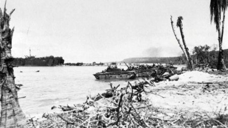
Operations of the EBSRs in New Guinea began in November 1942 with the arrival of the 2nd Engineer Special Brigade with its associated boat and shore regiments. Its operations ultimately encompassed over 1,600 miles of poorly charted coastline running from Milne Bay at the southeast tip of the island to Sansapor in the northwest. MacArthur’s strategy was to bypass and isolate Japanese strongpoints and attack weak Japanese defensive positions. Prior to 1944, the bulk of fighting had been carried on by Australian troops who defended Port Moresby and then secured the southeast corner of the island. With the coming of American troops and the EBSRs, Milne Bay and Buna became the first major US bases. These served as the staging areas for the MacArthur’s first major amphibious operation, the attack on Lae. The 2nd ESB, under General William Heavey, was an intrinsic part of that attack transporting men of the Australian 9th Division and supplies to the landing beaches. Lieutenant Colonel John Ellerbe (transferred from the C&GS), was on Heavey’s staff as nautical advisor and described the operation as follows:
“Upon my arrival at Oro Bay, I was plunged immediately into the thick of the planning of the Lae Operation… The usual work of preparing charts, tracks, diagrams, tables, and so forth, was the order of the day, except that, now that the landing was ‘for keeps’ instead of merely a training routine, we had only maps, photos, descriptions, and so forth, of the proposed far shore, from which to obtain our data. A few PT boats (Navy) had brought back sketchy reports, from investigations at night by radar and hand lead, on depths of water, reefs, and so forth, but most of the information was obtained from photos taken by the Air Corps.”
“General Heavey planned to take four of the staff officers, including myself, along on the landing. Accordingly, on 2 September we boarded a PT boat, and were landed a few hours later at Morobe, some 100 miles to the north. This bay was the point at which the Amphibian Regiment going into operation was bivouacked, and we made it our headquarters for the next two days….”
“Heavey and his staff boarded the lead ship of the attack convoy at Morobe and about midnight of 4 September we picked up about 50 Brigade boats,— they had proceeded northward several days before and were in hiding in a small bay. They fell in astern of the LCTs and the convoy proceeded, arriving off Red Beach at about 0400, 4 September. Since H-hour was 0645, there was a considerable period of waiting, laying to, until time to move in toward the beach. This period was without doubt the most nerve-wracking part of the entire operation, since we knew that we were at the mercy of the Japanese Air Force. Our vessels (close to 200 in number, since all the echelons had now come together) lay on the smooth calm waters like ducks sitting on a pond, and a hundred planes at daylight could easily have wrecked the convoy….”
“The naval bombardment of the beach was a beautiful thing to see. Tracers of all colours, from the DD’s 5-inch guns, curved lazily toward the beach, then striking, ricocheted toward the hills in the background in blazing loops of fire. The thunder of the guns was incessant, and shortly the explosions ashore had enveloped the entire area in clouds of smoke and dust, making a gray haze through which the landing craft had to make their way.”
“Promptly at 0645, the first waves hit the beach, and the invasion was on. Wave after wave, LCI, LCM, LCV, LCT, LST, hit, unloaded men and materials, retracted, and returned to the rendezvous area. By 0830, thousands of men and tons of gear were ashore….”
Following the taking of Lae, the next target was Finschhafen. Major Ector Latham (transferred from C&GS) of the 532nd EBSR was cited for “outstanding services during the development of the Finschhafen, New Guinea area from 22 September 1943 to 15 November 1943. At night and under adverse weather conditions, Major Latham piloted Naval and Brigade craft through uncharted and dangerous waters without mishap. He personally navigated the majority of early resupply missions from Lae to Scarlet Beach and Finsch Harbor. He displayed rare courage and coolness under enemy fire, always being an example to the officers and men under his command. In addition, Major Latham has prepared detailed hydrographic surveys of Kedam Point, Scarlet and Godowa Beaches. From these surveys he has charted and prepared sailing directions for Finsch Harbor, Langemak Bay, Schneider and Dreger Harbors.”
Following the capture of Finschhafen, Latham was also involved in an action north of Saidor, New Guinea, which is noteworthy as an example of hydrographic reconnaissance under combat conditions. On the night of 3-4 March 1944, Latham accompanied a motor torpedo boat (PT -193) to shoreline for the purpose of collecting hydrographic and topographic information. The vessel entered Sek Harbor at Alexshafen, New Guinea. When about 50 to 75 yards offshore, north of Sek Island, PT-193 opened fire on what was assumed to be a Japanese shore battery. The PT boat turned around and was leaving the vicinity while continuing to fire at the gun emplacement when it was fired upon by a machine gun emplacement. Most of the boat’s guns were firing at the first battery and could not be brought to bear on the firing machine gun. Latham manned an extra machine gun, firing on the hostile gun position. Subsequently, a twin 50 caliber was brought to bear on the Japanese weaponry. Unfortunately, the twin 50s were so arranged that, when firing, the muzzles were about one foot over his head. Latham suffered severe ear trauma and was under hospital care for about two months and received the Purple Heart Medal for this injury. He recovered in time for the Leyte landings in the Philippine Islands.
Lieutenant Colonel Ross Gilmore (transferred from C&GS) arrived in Milne Bay on 23 May 1944, and spent his first months in New Guinea ferrying LCMs up to Buna where they were relayed further up the coast for the Wakde, Biak, and Sansapor operations. On 10 August, he led 60 combat-loaded LCMs with approximately 2,000 troops up to Maffin Bay near the northwest end, a distance of 875 miles, in poorly charted waters with ongoing enemy activity. Many bypassed Japanese strongholds still existed on the New Guinea coast. The LCMs were 50- to 56-foot square-snouted vessels that made 6 knots under ideal conditions and 2 to 3 knots with full loads in a seaway. Gilmore was the navigator for all 60 boats and travelled in the lead boat approximately 1 mile ahead of the others. One night off the Sepik River, he awoke to check on the progress of the flotilla and looked over the ramp to see the black shape of a Japanese submarine lying on the surface not 50 yards off. He narrowly avoided colliding with the sub, but fortunately, the sub crew must have been as startled as Lt. Cdr. Gilmore as they chose to dive instead of open fire with their deck gun. On 25 August, he arrived safely in Maffin Bay with all boats, equipment and the 2,000 troops. Gilmore’s regimental commander angrily inquired where he had been to which Gilmore replied “Colonel, I’ve been getting your damned boats up here.”
Another 120 boats were convoyed up there without loss following the path blazed by Gilmore. Because of the poor to non-existent charts, these small-craft convoys with no naval escort travelled as far as 35 miles offshore during this operation. At Maffin Bay they staged for the Morotai landings. On 15 September, Gilmore landed at H+15 minutes at Red Beach and conducted lighterage operations until 20 September when he took over as beachmaster. With the capture of Morotai at the northeast end of the storied Moluccas, the stage was set for MacArthur’s liberation of the Philippines. Although hydrographers of the ESBs did not conduct large area surveys as did their naval counterparts, their skills were needed for reconnaissance surveys, planning of landing operations, piloting of small craft and management of beach operations. Their work aided in the reconquest of New Guinea and would prove to be invaluable in the liberation of the Philippines.

Value staying current with hydrography?
Stay on the map with our expertly curated newsletters.
We provide educational insights, industry updates, and inspiring stories from the world of hydrography to help you learn, grow, and navigate your field with confidence. Don't miss out - subscribe today and ensure you're always informed, educated, and inspired by the latest in hydrographic technology and research.
Choose your newsletter(s)


