The Longest Line
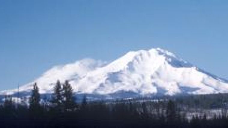
Mt. Shasta is a huge stratovolcano near the southern end of the Cascade Mountains of western North America. It rises to an elevation of 14,179 feet above sea level and is at the northern end of the Sacramento Valley of California. It is believed to have been named by early Russian settlers after a word meaning ‘white’ or ‘pure’, a reference to its snow-clad appearance virtually all year round. Because of its great elevation and prominence as a landmark and despite the fact that it is located at latitude 41.4 North, the United States Coast and Geodetic Survey (C&GS) chose to tie this peak into its 39th Parallel Survey, the first triangulation arc to cross the United States.
The 39th Parallel arc of triangulation was begun in 1871. The physiography of North America dictated that the arc be divided into three operational sections: western, central and eastern. The western section began at Point Arena, California, at latitude 38 degrees 55.9 minutes North and ended near Colorado Springs, Colorado, on the eastern slope of Pikes Peak. The intervening area was very mountainous and comprised the Coast Ranges, Sierra Nevada, the Basin and Range Province, the Wasatch Mountains, and the Rocky Mountains.
Many of the triangulation stations along this western section were placed on high peaks, assuring long lines of sight and intervisibility between points. A significant number were located at an elevation of over 10,000 feet. Most of these stations were located in remote frontier areas presenting great logistical difficulties and requiring a special breed of surveyor to accomplish the work. Among the men who had the knowledge, skill, strength, and physical stamina to accomplish this work year after year were George Davidson, William Eimbeck, Augustus Rodgers, and Benjamin Colonna. These men were designated assistants in the C&GS while an assortment of junior scientific personnel known as aids and sub-assistants accompanied the survey crews . Guides, wranglers, packers, heliotropers and assorted labourers rounded out the crews.
After reconnoitring the summit and selecting a suitable site for a station to be observed from upon distant mountain peaks on the 39th Parallel to the south, it was another six months before surveyors returned to the summit of the mountain. In October, Augustus Rodgers and a party of packers and builders proceeded to Mount Shasta in order to erect a large signal on its summit. This signal had been designed by Charles Schott, chief geodesist of the C&GS. The signal was made of twelve sections of galvanised iron mounted upon “8 brass bars bolted together in crib-form and surmounted by a copper conoid 3 feet high, nickel-plated and burnished.”
The nickel-plated conoid was meant to reflect sunlight so that the signal could be observed from a long distance. The total height of the signal was just under 15 feet. It took a week of labour to pack this edifice to the summit and erect it. Fortunately there had been relatively light snowfall earlier in the year and no fall storms of note or the project would have been impossible.However, Rodgers and his party suffered from intense headaches and inability to sleep due to the rarefied atmosphere.
The signal sat on top of Mount Shasta for the next three years with no further C&GS work. However, in July of 1878, a survey party under Benjamin Colonna arrived at Sisson’s, a resort twelve miles from the summit, in order to begin preparations to conduct survey operations on Shasta. The total equipment and supplies to be packed to the summit totalled 750 pounds (341kg) so native American Indian packers were hired. Upon leaving Sisson’s, Colonna related, “Nearly everyone in the party was mounted, and it was a somewhat noisy company, in which the voices of the braves and squaws were mingled with the crying of papooses and the barking of dogs, so that no one sound was clearly distinguishable.” Few of the Indians had ever been to the summit as they seemed to consider it a sacred place and, because of its snowy white mantle, a symbol of purity. At 3:00 p.m. the tree line was reached and the party stopped to camp for the evening with the peak towering above them. Sleep for Colonna and the other C&GS personnel was interrupted by the chanting of the accompanying Indian medicine man who was preparing his followers for the next day’s ascent.
The trip to the summit began in earnest the next morning; the pack horses were left behind and each person carried a 35 to 40 pound load. Steep slopes, frozen snow with the possibility of sliding 3 or 4 thousand feet below, and loose boulders which were dislodged by the various packers added to the danger of the final ascent. At an elevation of about 13,000 feet, the medicine man gave out and a younger man took his load, while the strongest packers only advanced 50 or 60 yards at a stretch before stopping to rest. When attaining the summit, many threw themselves on the snow and refused to move. However, by the next morning a sufficient number were recovered in order to set up an observing tent with theodolite and heliotrope and Colonna began work observing Mount Lola and Mount Helena. George Davidson was on Lola while only a heliotroper was on Helena. For several days the smoke from forest fires was so dense that Colonna could only see 20 miles in any direction. The highest temperature during the day was 67 Fahrenheit but at night it dropped as low as 18 making camping on the mountain uncomfortable at best. However, on the night of 31 July, the wind came out of the north and in Colonna’s words:
“Friday, August 1, proved to be the day I had been waiting for. The wind had hauled to the northward during the night, and the smoke had vanished as if by magic. At sunrise, I turned my telescope in the direction of Mount Lola, and there was the heliotrope, 169 miles off, shining like a star of the first magnitude. I gave a few flashes from my own, and they were at once answered by flashes from Lola. Then turning my telescope in the direction of Mount Helena, there, too, was a heliotrope, shining as prettily as the one at Lola. My joy was very great; for the successful accomplishment of my mission was now assured. As soon as I had taken a few measures, I called Doctor McLean and Hubbard to let them see the heliotrope at Mount Helena, 192 miles off, and the longest line ever observed over in the world.” Colonna, expressing joy and pride, related in the same report: “And the glory is ours” for we “can boast of the largest trigonometrical figures that have ever been measured on the globe.”
The longest line observed up to that point had been a line measured by French geodesists that ran across the Mediterranean Sea from Spain to Algeria, a distance of 169 miles. Colonna’s line was not eclipsed until the 1950s when US Army geodesists measured a line between Puerto Rico and the Dominican Republic and observed a signal flare at night that had been shot upward. The distance observed was more than 210 miles. But, Colonna’s accomplishment stands as a monument to physical stamina and perseverance. If not one of the great accomplishments of classical geodetic methods, it certainly was unique. A few years later Colonna was injured in a fall while working on the slopes of Mount Olympia, Washington, and suffered partial paralysis from which he never recovered. He was then transferred to the headquarters of the Coast and Geodetic Survey where he rose to become assistant in charge, the second highest ranking official in the Survey. He died in 1924, 46 years after his sojourn on Mount Shasta.

Value staying current with hydrography?
Stay on the map with our expertly curated newsletters.
We provide educational insights, industry updates, and inspiring stories from the world of hydrography to help you learn, grow, and navigate your field with confidence. Don't miss out - subscribe today and ensure you're always informed, educated, and inspired by the latest in hydrographic technology and research.
Choose your newsletter(s)


