The Outlook for Galileo
Progress and Predictions for European GNSS
Hydro international brings you the recent progress in the much-troubled European satellite navigation system, Galileo. We discuss the motivation behind such a scheme, the problems with funding and the procurement process currently underway. Although costs are spiralling, the anticipated benefits to the economy in terms of revenue, employment and expanding markets are many. Since Galileo is being funded by the EU taxpayer, it is important that projected benefits are realised.
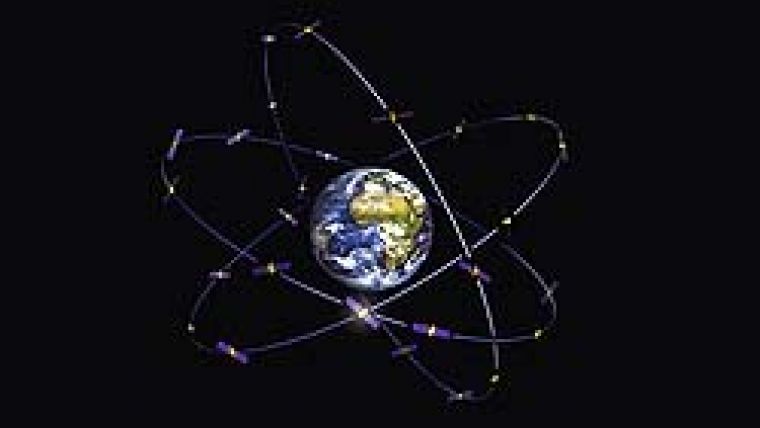
Galileo will be Europe's global navigation satellite system (GNSS), which will complement and rival the US Global Positioning System (GPS) and the Russian GLONASS (see ‘Global Navigation Satellite Systems', Hydro international, September 2006). From a network of 30 satellites and several ground stations, Galileo will provide users with a highly accurate positioning service (Figure 1).
Galileo Services
This positioning information, based on precision timing, will be used in many areas such as transport (vehicle location, route finding), social services (assistance for elderly or disabled), the justice system and customs (suspect location, border controls), public sector (GIS), leisure (at sea or in the hills) and navigation. Table 1 lists the range of navigation and search-and-rescue services that will be provided.
| Service
| Details
|
| Open-access navigation
| Free to all with a suitable receiver; simple timing and positioning to an accuracy of 1m
|
| Commercial navigation
| Encrypted service for a fee; positioning with an accuracy of centimetres
|
| Safety-of-life navigation
| Very high quality, for safety-critical applications such as aviation and shipping
|
| Public-regulated navigation
| Encrypted service for public agencies (e.g. security and law enforcement); continuous availability
|
| Search and rescue
| Will determine location of distress beacons
|
Table 1: The five Galileo services for navigation and search-and-rescue services.
The first three services listed in Table 1 are already being provided by the European Geostationary Navigation Overlay Service (EGNOS), the essential first step in the development of Galileo. Consisting of three geostationary satellites and a network of ground stations, EGNOS augments the existing GPS and GLONASS systems. EGNOS sends receivers in Europe information on the reliability and accuracy of GPS and GLONASS, making them suitable for safety-critical applications.
Interoperability
Interoperability refers to the ability to use any combination of the three networks - Galileo, GPS and GLONASS - in order to obtain an enhanced service. The EU and the USA signed an interoperability agreement in July 2007, agreeing on a common civil signal design. By incorporating the multiplexed binary offset carrier (MBOC) frequency, future users will be able to obtain signals from either using a single handset. Similarly, discussions are underway between the Russian Federal Space Agency and the EU to ensure a degree of interoperability between GLONASS and Galileo. The ability to receive signals from more than one GNSS can only mean improved continuity and accuracy.
Motivation
Satellite positioning using GPS has become the standard method of navigating for many transport systems. Having an independent European navigation system has been the main motivation for constructing Galileo; however, problems with GPS accuracy, availability of service and coverage at high latitudes are also well documented. Since Galileo is a civilian service (compared to military-run GPS), availability in all but the most extreme circumstances is guaranteed. Compared with GPS accuracy of several metres, the dual-frequency service will provide real-time location accuracy to within a metre. By launching the 30 satellites into orbits of greater inclination to the equatorial plane, Galileo will provide a service of higher accuracy at polar latitudes.
Funding Crisis
Galileo was originally planned to be a public-private partnership (PPP). In 2006, it was intended that private companies and the EC/European Space Agency (ESA) would jointly contribute amounts of two-thirds and one-third of the cost, respectively, towards the estimated EUR2.4 billion cost of the deployment phase. However, the consortium of eight leading aerospace and telecom companies, known as the European Satellite Navigation Industries, formally abandoned the project in early 2007. The companies could not reach agreement on issues such as how lucrative contracts should be allocated, and the EU took control.
There followed a period of great uncertainty for Galileo due to a lack of public funds. Although the original aim had been to have the system operational by 2008, only one test satellite was in orbit in 2007 and only four of the 30-satellite constellation had been ordered. The EC proposed to fund 100% of the project with public funds, with the system being operated by private companies. The funding was to come from the surplus agriculture and administration budgets for 2007 and 2008 (which led to the project being referred to as the ‘Common Agricultural Policy of the sky').
In November 2007, 27 EU transport ministers finally approved the project. Spare agricultural funds were used to finance the system, with a new completion date of 2013. There are many objectors, however, due to the increase in cost of Galileo. Many EU members believe the funding should have been diverted towards improving current transport systems. However, supporters point out that although costs are spiralling, the projected commercial benefits from the system will continue to outweigh costs.
Progress
Signal transmission and reception testing began with the first of the GIOVE (Galileo In-Orbit Validation Element) series in 2005. GIOVE satellites are transmitting signals in the frequencies that will be used by the future Galileo satellites, and cannot be used for navigation. GIOVE-A (Figure 2) is still operating today, although it was only expected to have a lifetime of 27 months. The second test satellite (GIOVE-B, Figure 3) was launched in April 2008 from Kazakhstan, and is said to be "working well". Its payload included the very first maser atomic clock to be flown.
A tender process was put forward in July 2008 for the six proposed areas of work: system support; ground mission segment; ground control segment; space segments (satellite); launch services; and operations. Any one company is not allowed to win contracts in more than two areas. Of the 21 industrial groups who originally expressed an interest in competing for contracts, a shortlist of 11 was formed in September 2008. It is anticipated that all contracts will be in place by mid-2009. The four in-orbit validation satellites are being constructed, and the first is expected to be launched into orbit in 2010. Two ground control centres are in the process of being built.
Galileo Projections
A conference on the topic of progress in Galileo was attended by policy-makers, researchers and industrial partners in Brussels in January of this year (‘Building Galileo'). Presentations were made on programme status and key GNSS market predictions and climate. According to the European GNSS Supervisory Authority (GSA), Galileo and EGNOS mean a huge increase in business for both downstream (i.e. device manufacturers and service providers) and upstream (i.e. satellite construction and telecommunications) industries. By examining potential user needs, a ‘limitless' range of services, applications and business opportunities can be defined.
Galileo will be able to contribute to industries such as location-based services (LBS), road, rail, aviation and maritime. Despite the current economic crisis, it is anticipated that Galileo will benefit the economy by the order of EUR60 billion by 2030 (Figure 4). According to business consultants LEK, around 30% of the population will be using navigation and emergency services by 2020; this implies that a total of three billion handsets will be on the market. The proportion of vehicles with in-built navigation devices is predicted to be 50% by 2020. It is estimated that from 2015, all new commercial aircraft will be fitted with a dual GPS/Galileo receiver.
Near Future
It is anticipated that the improved accuracy and integrity of Galileo will encourage a flood of new applications in key downstream markets. LBS and road GNSS are expected to demonstrate huge increases in revenue. Many other market opportunities are likely to arise in other transport industries. As well as providing thousands of jobs, it is thought that Galileo will also increase competitiveness in European industry. Despite its troubled financial history and the current economically challenged climate, the future appears to be extremely promising for Galileo. It is hoped that the question of whether projected benefits to the economy will actually outweigh the growing costs of deployment will be answered in the near future.

Value staying current with hydrography?
Stay on the map with our expertly curated newsletters.
We provide educational insights, industry updates, and inspiring stories from the world of hydrography to help you learn, grow, and navigate your field with confidence. Don't miss out - subscribe today and ensure you're always informed, educated, and inspired by the latest in hydrographic technology and research.
Choose your newsletter(s)


