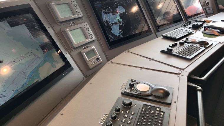
The Sun Shines on Nautical Charts in Different Ways
Just recently someone reminded me about the 20th anniversary of the finalization of the first official type-approval of an ECDIS device. Indeed, it was in summer 1999 that all sea trials and technical tests at the labs of the Federal Maritime and Hydrographic Agency of Germany were completed and, being in charge of this process at the time, I signed the official certificate to confirm that the Transas Navisailor device met all applicable IMO and IHO standards. We did our best to confirm software stability and physical robustness of the device based on the very small range of S-57 ENCs available.
After nearly two years of application of all the mandated test scenarios, the manufacturer was enthusiastic and the sun appeared to shine brightly on the glorious future of digital and paperless navigation. As we all know, it eventually turned out that way – but not immediately. I must confess that both the manufacturer and I were naïve about the progression of global ENC coverage. It took another ten years before substantial numbers of ENCs were on offer for major routes and ports. Likewise, we were much less aware of software’s nasty habit of never being completely free of errors, quality assurance procedures for software and data production were not mature, and many traditionalists challenged the idea of digital navigation at sea in general. I clearly recall the year-long struggle at IMO to achieve the ECDIS carriage requirement acceptance.
The lack of ENCs was a deterrent, but on the other hand a good number of devices utilizing private data were already in the field and there was great enthusiasm among those mariners who used them. That new means for navigation yielded its own spin-off – well before any other digital track control for transport carriers on land and in the air. Although in hindsight the issuance of the first certificate may seem to have been premature, it generated two outcomes: 1) hydrographic offices began to understand that the ECDIS concept was transforming from a vision into a reality and started to prepare for regular ENC production, and 2) a fully new industry sector was born to create chart data production and dissemination software, and navigational equipment manufacturers increased their engagement to develop IMO-compliant ECDIS systems for certification.
Frankly, on the day of signing the ECDIS certificate I didn’t have the strategic foresight to anticipate what would happen. But having lived through this experience, I wonder what we can learn from it based on the current situation. Now, after a 20-year transition period of uptake, establishment and consolidation of ECDIS as the navigation means at hand, the sun is setting on paper charts. Noting the steady decrease in paper chart sales and the digitization of our whole information environment, it seems likely to me that the global paper chart system as we know it today will not be sustained for another ten years.
Just like we sometimes print out an e-mail to obtain something tangible on which we can scribble, we may send selected ENC coverage areas to a mid-size A3 or A2 printer through a converter which transforms the ENC content into a paper chart presentation; however, that will be all. Full paper chart folios will probably only remain on navy vessels. I am sure that commercial shipping, fishery and leisure craft will go effectively paperless.
To reduce paper (almost) completely to a back-up position, however, another digital evolution is needed. Practitioners know that safety of navigation requires more information than just what is included in ENCs. Navigational warnings, tides and currents, ice, weather… all this information somehow finds its way digitally onto a ship’s bridge nowadays, but – so far – it is difficult to seamlessly integrate it all to create a consistent image of the situation at hand. This has been known for a long time and the concepts to overcome the challenge are no longer sensationally new but, just like in the early days of ECDIS uptake, the standardized ‘digital fuel’ needs to be provided on regular services – and with substantial coverage – before it can take effect in the field.
The IHO S-100 framework offers this promise by the concept and has now matured enough to transform from a vision into a reality. As in the early ECDIS/ENC days, it starts with test beds and collaboration between national hydrographic offices and industry. In contrast to the laborious start for ENC services 20 years ago, I see three major differences: 1) there is full awareness among the administrative partners that substantive regional coverage of the various sorts of S-1xx thematic information packages should be available right from the start and elevate to global coverage in a relatively short time; 2) marine spatial data infrastructure including bandwidth for wireless data transmission is in place and can assist; and 3) industry players are ready to upgrade their software for data production systems, data provisions and end-user devices.
The sun is about to rise over the fully integrated approach to ship navigation and will shed its first light on IHO’s new roadmap for S-100 implementation. My prognosis is that it will take much less than ten years before transformation of ECDIS to the next level of integration will take effect. And it will be so much more than nautical charting.

Value staying current with hydrography?
Stay on the map with our expertly curated newsletters.
We provide educational insights, industry updates, and inspiring stories from the world of hydrography to help you learn, grow, and navigate your field with confidence. Don't miss out - subscribe today and ensure you're always informed, educated, and inspired by the latest in hydrographic technology and research.
Choose your newsletter(s)


