SonarWiz 7 Introduces Seabed Characterisation Tool
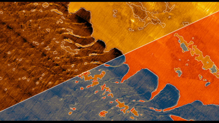
One feature of SonarWiz 7 is the Seabed Characterisation tool. It incorporates bathymetric slope, roughness, TPI and any spatially distributed variable that can aid the characterisation algorithm to generate classes of texture.
From that, it produces a vector polygon layer that can be exported for use outside SonarWiz.
Unlike producing the analysis in a GIS or image processing package, SonarWiz performs the analysis BEFORE the data is mosaiced and geo-referenced. This greatly reduces the impact of artifacts in the nadir and far field, which can be difficult to remove and cause unnecessary rework.

Value staying current with hydrography?
Stay on the map with our expertly curated newsletters.
We provide educational insights, industry updates, and inspiring stories from the world of hydrography to help you learn, grow, and navigate your field with confidence. Don't miss out - subscribe today and ensure you're always informed, educated, and inspired by the latest in hydrographic technology and research.
Choose your newsletter(s)


