The emergence of AI in hydrography
Preparing for hydrographic artificial intelligence networks and systems
With the ever-increasing and affordable availability of capacity and computing power to process and store data, the emergence of artificial intelligence (AI) in marine geomatics, ocean sciences and hydrography is palpable.
Mathematical models are very powerful, but their reliability must be validated and demonstrated using calibration points. It’s the same for AI. It cannot emulate and learn properly if it cannot rely on observations that represent reality. In the commercial shipping world, AI-based technologies are about to be tested, resulting in additional bathymetry and hydrography needs that will quickly become necessary and critical.
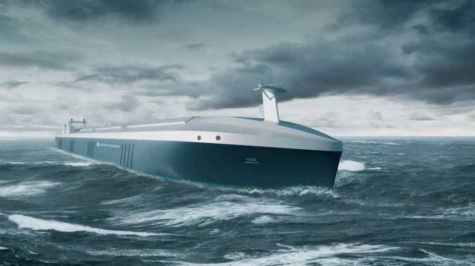
Commercial Marine Autonomous Surface Ships (MASS) such as the ‘Rolls Royce-Kongsberg’ are prototypes in development and will eventually be tested in Europe – Norway is a leader in the field. Many see these commercial MASS as providing for economies in terms of fuel consumption, optimization of transportation routes, reduction of greenhouse gas emissions and reduced risks to navigation by respecting many rigid and strict rules of navigation in the world.
How can commercial MASS learn, if indeed they can learn, from the charted and uncharted seabed where hydrographic data is insufficient or even absent? I suggest that the success of AI in hydrography is fundamentally dependent on the quantity and quality of all available bathymetric and hydrographic data, whether static, predictive, near real-time or real-time (dynamic).
Lack of basic data
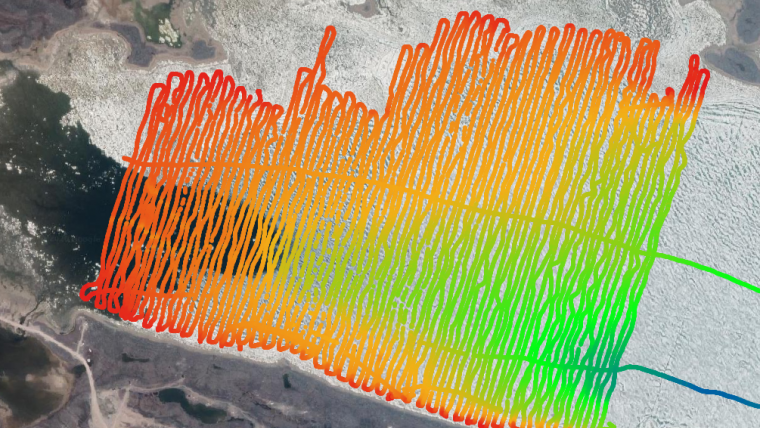
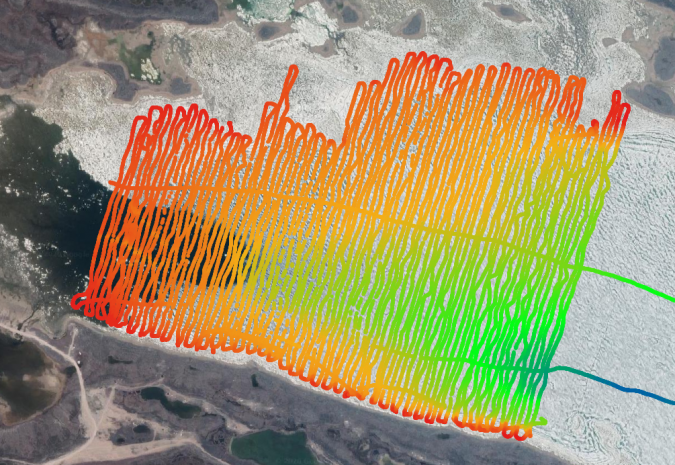
In the world of ocean sciences (bathymetry and hydrography), there is a lack of basic data that meets modern technological standards. However, the data acquired with multibeam echo sounders (MBES) has for some decades been localized and is increasingly dense and voluminous. Also, the additional data coming from MBES and specifically its multiplier effect of backscatter data signal, and the Lidar and Satellite-Derived Bathymetry (SDB) multiplier effect of reflectance data signal, amplifies this further.
I emphasize that there is also a lot of unknown, unavailable data, and when it is known and made available, it is often non-standard and low precision. For this reason, it tends to be unused or rejected. Since AI is based on computing ability and the power of mathematics and statistics, the availability of all data, especially big data, plays a key role in computer learning, machine learning and deep learning.
Respecting established standards
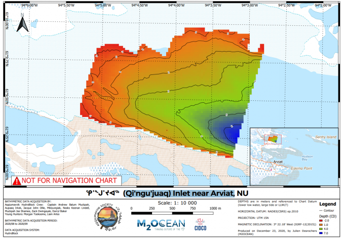
AI in hydrography will be stimulated and catalysed by MASS. The key to success will be based on the same fundamental issue known in hydrography for a long time (i.e. associated bathymetric and hydrographic data of known quality and respecting established standards). This represents a major challenge considering that the vast majority of the world's oceans and coastal areas have little or no modern hydrographic data of sufficient quantity and quality. However, there are several opportunities with the current technological wave that we are encountering.
To prepare for hydrographic AI, it is better to have the maximum quantity of data where the quality is known, even if it does not always meet the standards, than not having the data, or having just a little data. This is especially true in remote areas where new needs emerge.
Alternative data sources
In this context, promoting and adopting Crowdsourced Bathymetry (CSB) and the unreserved use of alternative data sources such as SDB, airborne hydrographic Lidar and autonomous data acquisition vehicles (airborne, surface and submarine) is a must and will even be forced and accelerated more than ever.
For hydrographic data, ideally, the most accurate and exact data is needed. On the other hand, in the context of AI in hydrography, I suggest that all data, even if inaccurate or imprecise, is of interest. Rather than being obsessed with precision and accuracy, we must accept data for which the accuracy and precision would not be sufficient for traditional standard purposes. By knowing or even ‘qualifying’ the precision and accuracy, this data will allow the machine and deep learning algorithms to identify areas of risk to avoid for some current and future MASS.
Challenges and opportunities
What currently appears to be incomplete and imprecise could, in the context of AI, enable a paradigm shift in which hydrographic data reaches unexpected maturity through repetition and mathematical/statistical correlation in the future.
The emergence of AI in hydrography is full of challenges and, more importantly, opportunities. This is an exciting and important developing field to follow everywhere in the world and especially in the hydrographic community. With three oceans and the longest coastline in the world, Canada should clearly have an interest in playing a pivotal role in the issue of ‘How to prepare for Hydrographic Artificial Intelligence Networks and Systems’.

Value staying current with hydrography?
Stay on the map with our expertly curated newsletters.
We provide educational insights, industry updates, and inspiring stories from the world of hydrography to help you learn, grow, and navigate your field with confidence. Don't miss out - subscribe today and ensure you're always informed, educated, and inspired by the latest in hydrographic technology and research.
Choose your newsletter(s)


