World Hydrography Day 2018 Celebrated in Jakarta
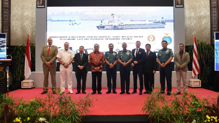
On 17 September 2018, the Indonesian Hydrographic Office (Pushidrosal) organised an international seminar in Jakarta, Indonesia, to celebrate the 97th anniversary of World Hydrography Day (WHD). The objective of the seminar was to enlighten participants’ perspectives on the need for high-quality bathymetric data for more accurate maritime planning and governance. This objective was aligned with the World Hydrography Day 2018 theme: ‘Bathymetry – the foundation for sustainable seas, oceans, and waterways’.
The seminar delivered topics related to the need for high-quality bathymetry data for enhancing the confidence level of the users, the role of the hydrographic office in building a smart nation, the importance of the national hydrographic office for a state, and hydrography’s role in and contribution to a state’s economic development.
In his opening remarks, Rear Admiral Harjo Susmoro, Indonesia’s Chief Hydrographer, stated that all members of IHO reiterate their commitment to raising awareness of the importance of hydrography; in particular through maintaining standards and publishing in correlation with the relevant international standards, providing capacity building and assistance to those countries where hydrographic services require improvement, by encouraging the collection and discovery of new hydrographic data through programmes such as crowd sourcing and satellite-derived bathymetry, and by ensuring the widest possible availability of this data through the development of national and regional Marine Spatial Data Infrastructures.
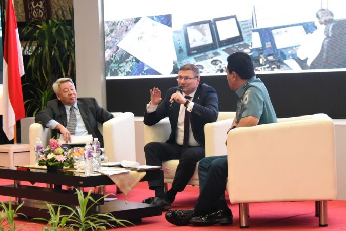
The speakers at the seminar included:
- Mr Budi Halim from Indonesia Ship-owners Association (INSA): ‘The need for Electronic Nautical Charting (ENC) for economic value and its role in sustainable development of marine transport operations’ (INSA)
- Mr Eric Fremouw from Reasonuance Consultants/Veris Australia: ‘Bathymetry usage for maritime infrastructure’
- Dr Parry Oei, Singapore Chief Hydrographer: ‘Enhancing regional cooperation to provide high-quality bathymetry data in strategic sea lanes’
- Prof Dr Ir Rokhmin Dahuri, MS from Indonesian Experts: ‘The importance of hydrographic role to support sustainable seas, ocean and waterways’
- Dr Mathias Jones, Secretary General of IHO: ‘Data-centric hydrography bringing marine knowledge into effect’.
The seminar was also attended by Rear Admiral Harjo Susmoro, Hydrographer of Indonesia, and Rear Admiral Tim Love OBE, National Hydrographer UKHO, among others.
The origins of this seminar can be traced back to the message of the Indonesian President, Joko Widodo, who during his inaugural court on 20 October 2014 highlighted a statement that Indonesia will finally return to its roots and identity as a maritime nation. This will be based on five key areas of development or ‘pillars’: maritime culture, maritime economy and resources, maritime infrastructure and connectivity, maritime diplomacy, and maritime security. Those pillars are jointly constructing the so-called Global Maritime Fulcrum (GMF) vision. This vision will reflect in Indonesia’s geopolitical contexts, which will govern a novel geostrategy for both regional and global recognition.
The strategy within the GMF vision emphasises the need for an intensified connectivity among islands in the archipelago. The Maritime Highway programme is expected to improve exchange of goods and resources between regions throughout the Indonesian ocean territory. New ports and sea routes shall be opened along with building of new passengers and cargo vessels. With the escalating marine traffic, the need for data and information along the waterways will be on the rise. Ensuring safety and security of shipping and protected sea environment will be part of the development. An effective marine highway will be the backbone of maritime economy being one of the pillars of GMF vision.
It is the obligatory mission of the Indonesian Hydrography and Oceanography Center (Pusat Hidrografi dan Oseanografi - Pushidrosal) as one of Main Command Forces under the Indonesian Navy in carrying out ocean survey, mapping and research. Issuing nautical publication and prediction of dynamics of ocean environment for the purpose of safety of waterways navigation add to Pushidrosal’s obligatory mission. The mission is not only for the benefit of the armed forces but also for greater public interest. As a state member of the International Hydrography Organization (IHO), Indonesia is represented by Pushidrosal.

Value staying current with hydrography?
Stay on the map with our expertly curated newsletters.
We provide educational insights, industry updates, and inspiring stories from the world of hydrography to help you learn, grow, and navigate your field with confidence. Don't miss out - subscribe today and ensure you're always informed, educated, and inspired by the latest in hydrographic technology and research.
Choose your newsletter(s)


