An automated and reliable solution for the generalization of nautical charts
Cartographers working in hydrographic offices and ENC editors have the responsibility of processing...
GEOMOD is a software development company specialized in marine geomatics and hydrography. Since 2004, we have been building our expertise on hydrographic products dedicated to mariners, harbour workers, and hydrographic offices. Our products are aligned with requirements of the IHO (International Hydrographic Organization): The S-57 standard for Electronic Navigational Charts (ENC), and the new hydrographic data model: S-100, still under development, that we are following closely. Since 2021, GEOMOD has become a member of the COEXYA group (Formerly SWORD group) in order to put in common their respective expertise.
Dedicated to the mission of providing seafarers, harbours and cartographers with reliable and high-quality services, GEOMOD has been working to develop the following products/deliveries:
PortAll is a dynamic web application intended for harbour workers. The tool is organized by features dedicated to each harbour service (hydrographers, harbour managers, mariners, dockers…), and allows all these services to exchange the necessary information (Real-time data, most up-to-date harbour info…) in an efficient way.
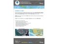
As an accredited ENC producer registered in the IHO list S-62, GEOMOD is able to deliver the creation of specific S-57 Electronic navigational charts. This service is provided to harbours or hydrographic offices requesting the creation of their own Harbour ENCs (electronic navigational chart). These ENCs are more precise than the ENCs produced by hydrographic offices since cover the smaller areas of the concerned harbours and follow a different Navigational Purpose. Their purpose is to answer the needs of harbour workers, such as pilots.
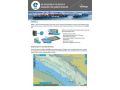
The creation of official S-57 ENCs is performed by cartographers of Hydrographic Offices around the world. For that purpose, they have to deal with high-density bathymetry datasets covering the seabed, which are made heavier and heavier by the constant progress in data acquisition. Following the request of Shom (French hydrographic office) cartographers to develop a tool helping them in this task, GEOMOD developed CALHYPSO: An automated tool and a service for cartographic and hydrographic offices for creation and update of bathymetry charts.
CALHYPSO allows:

Cartographers working in hydrographic offices and ENC editors have the responsibility of processing...
This site uses cookies. By continuing to use this website, you agree to our Cookies Policy. Agree