Lidar technology shines along the Alaska coastline
The National Oceanic and Atmospheric Administration (NOAA) contracted NV5 Geospatial to define the s...
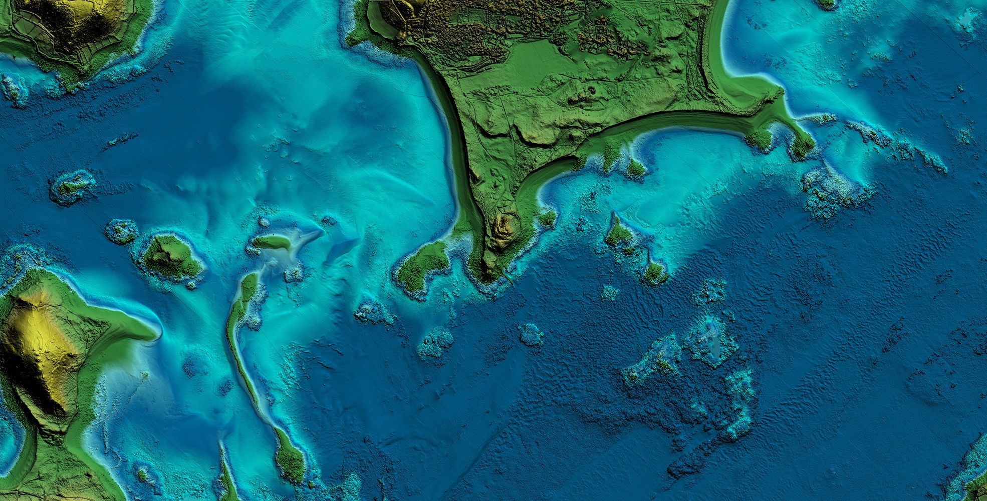

Superior Airborne Bathymetric Lidar Sensor
Leica Geosystems’ airborne bathymetric sensor Leica Chiroptera-5 combines topographic and bathymetric Lidar channels with a four-band camera to deliver seamless data from water to land. The system provides 40% higher point density, a 20% increase in water depth penetration and improved topographic sensitivity compared to previous generations. The high-performance airborne sensor delivers detailed Lidar data of submerged terrain and objects and supports numerous applications, such as nautical charting, erosion risk assessment, environmental monitoring and seabed classification.
Increased Productivity
The superior sensor performance of the Leica Chiroptera-5 allows to collect more data and capture larger areas with greater detail. The system is designed to address the growing need to collect high-accuracy data for environmental monitoring and surveying of shallow-water regions. Combined with the Leica HawkEye deep bathymetric module, Chiroptera-5 offers unmatched capabilities in deep waters, covering the full bathymetric range.
High-performance Processing Workflow
The LSS end-to-end data processing workflow provides full waveform analysis and automatic calibration, refraction correction and turbid water enhancement. The workflow offers near real-time data processing, enabling coverage analysis immediately after landing and allowing operators to QC the data quickly before demobilizing the system.

The National Oceanic and Atmospheric Administration (NOAA) contracted NV5 Geospatial to define the s...

Hexagon is working with Beneath The Waves, a conservation NGO, to help protect marine environments i...

Arctia-Meritaito has efficiently produced a seamless digital terrain model of land and water along t...

Find detailed technical information about the Leica CountryMapper and view brochures, videos and case studies and compare it with other similar products

Find detailed technical information about the Leica HawkEye-5 Bathymetric LiDAR Sensor and view brochures, videos and case studies and compare it with other sim...

Find detailed technical information about the Leica DMC-4 Airborne Imaging Sensor and view brochures, videos and case studies and compare it with other similar...

Find detailed technical information about the Leica Chiroptera-5 Bathymetric & Topographic LiDAR and view brochures, videos and case studies and compare it with...

Find detailed technical information about the Leica FlightPro Flight Management & Control System and view brochures, videos and case studies and compare it with...

Find detailed technical information about the Leica MissionPro Flight Planning Software and view brochures, videos and case studies and compare it with other si...

Find detailed technical information about the Leica TerrainMapper-2 and view brochures, videos and case studies and compare it with other similar products

Find detailed technical information about the Leica XPro - Post Processing Software and view brochures, videos and case studies and compare it with other simila...

Find detailed technical information about the Leica ADS100 Airborne Digital Sensor and view brochures, videos and case studies and compare it with other similar...

Find detailed technical information about the Leica LiDAR Survey Studio and view brochures, videos and case studies and compare it with other similar products

Find detailed technical information about the Leica HxMap and view brochures, videos and case studies and compare it with other similar products

Find detailed technical information about the Leica SPL100 Single Photon LiDAR Sensor and view brochures, videos and case studies and compare it with other simi...

Find detailed technical information about the Leica CityMapper-2 and view brochures, videos and case studies and compare it with other similar products
This site uses cookies. By continuing to use this website, you agree to our Cookies Policy. Agree