RIEGL and Schiebel cooperate to enhance UAV-Lidar bathymetric mapping
RIEGL Laser Measurement Systems and Schiebel have successfully completed the integration of a high-e...
RIEGL – Topo-Bathymetric Airborne Laser Scanners and Systems
RIEGL is a leading provider of cutting-edge Waveform-LiDAR technology in airborne, mobile, terrestrial, and UAV-based laser scanning.
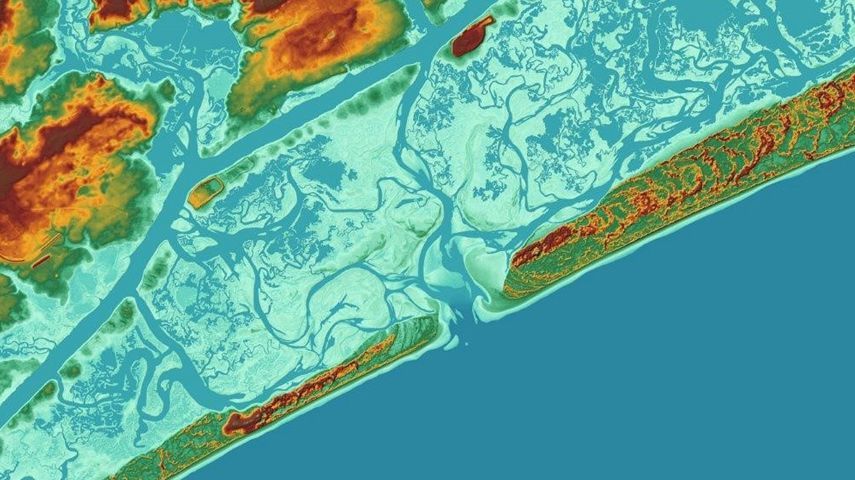
The strengths of LiDAR technology in a hydrographic context are the collection of seamless data sets that span the land/water interface, enabling high-resolution surveying of both above and below water surface topology in high efficiency.
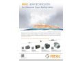
For airborne combined topo-bathymetric applications, RIEGL offers the fully integrated laser scanning systems VQ-880-G II and VQ-880-GH. Providing a water penetration of 1.5 Secchi depths, they are ideally suited for efficient large-area coastline and shallow water mapping, river bed profiling, measurement of aggradation zones, hydro-archaeological surveying, etc.
These turnkey surveying systems include a high-end IMU/GNSS unit and up to two cameras (e.g., RGB and IR) and are fully calibrated off-factory. The integrated infrared laser scanner complements the data from the green laser scanner and supports the detection of the water surface. The compact and robust housing is compliant with typical aircraft hatches and stabilized platforms. The VQ-880-GH’s form factor with reduced height is specifically optimized for helicopter integration.
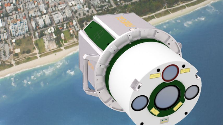
The low weight and compact design of the Topo-Bathymetric Airborne Laser Scanners RIEGL VQ-840-G and RIEGL VQ-840-GL allow for integration of these systems on smaller aircraft and UAVs - ideal for detailed data acquisition in smaller-scale applications that need to be carried out at shorter intervals, such as coastal erosion monitoring, surveying port infrastructure or rivers at risk of flooding. These scanners provide more than 2 Secchi depths water penetration and high spatial resolution due to a measurement rate of up to 200 kHz and selectable laser beam divergence.
Complementing airborne data of large-scale and deepwater surveys (conducted by using other surveying methods like sonar) with UAV-borne more detailed topo-bathymetric data enables datasets with extremely high information content.
Additionally, topo-bathymetric data can be merged with LiDAR data acquired by terrestrial or mobile laser scanning. RIEGL Mobile Laser Scanning Systems are designed to be easily integrated to moving platforms, so also on boats. Their millimeter precision paired with high grade IMU/GNSS units enables precise point cloud geo-referencing for a variety of shipborne surveying applications, such as mid-range shoreline mapping as well short-range applications that result in feature-rich digital twins of e.g., harbor infrastructure, bridge structures or river banks. RIEGL VZ-i Line 3D Laser Scanners – in combination with the corresponding kinematic app – can be mounted on boats to capture shoreline data or data of bridges and other infrastructure.


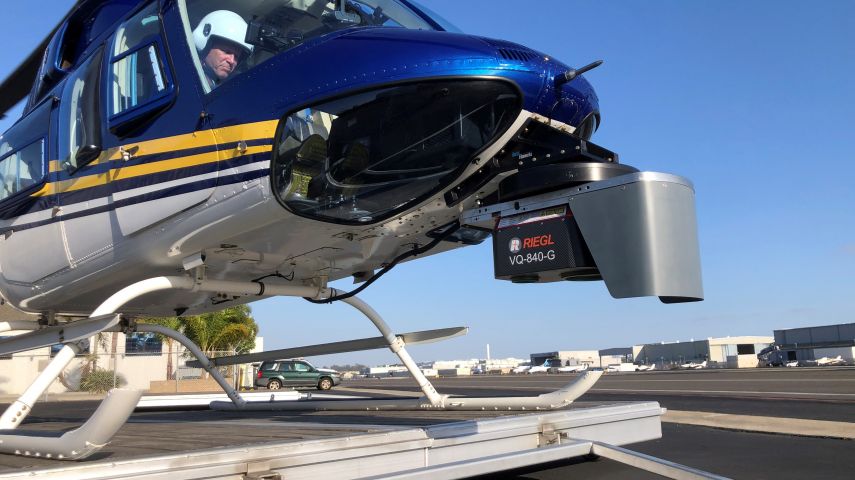


RIEGL Laser Measurement Systems and Schiebel have successfully completed the integration of a high-e...

The RIEGL VQ-840-G is a compact Topo-Bathymetric Airborne Laser Scanner especially suited for coastl...

Find detailed technical information about the VQ-840-G and view brochures, videos and case studies and compare it with other similar products

Find detailed technical information about the RiHYDRO and view brochures, videos and case studies and compare it with other similar products

Find detailed technical information about the VQ-880-GII / VQ-880-GH and view brochures, videos and case studies and compare it with other similar products

Find detailed technical information about the VQ-840-GL and view brochures, videos and case studies and compare it with other similar products
This site uses cookies. By continuing to use this website, you agree to our Cookies Policy. Agree