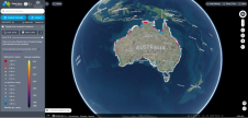
Hydro International proudly presented from 26 April to 30 May 2021 the Shallow Water and Coastal Mapping Weeks, highlighting the topics of shallow water and coastal mapping. Featuring new tools and technological progress in mapping shallow water topography and coastal environments.


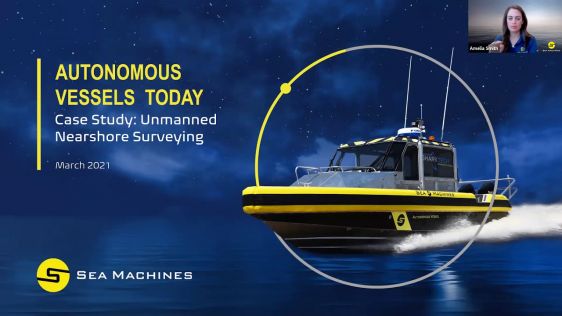
Amsterdam-based survey company Deep B.V. recently upgraded vessel operations with a Sea Machines Robotics autonomous command and remote-helm control system installed aboard its Loeve hydrographic surv...

10-minute product presentation followed by a Q&A session. We recently unveiled our new SeapiX-C solid-state 3D multibeam sonar dedicated to high-precision marine works. Providing increased efficiency ...
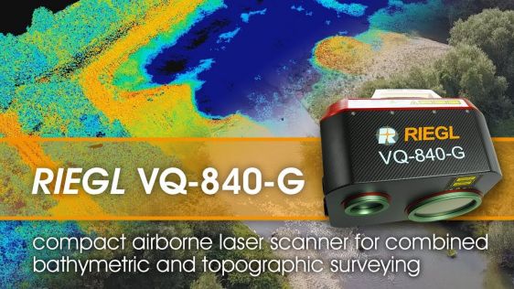
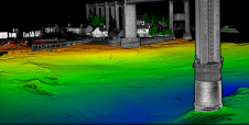
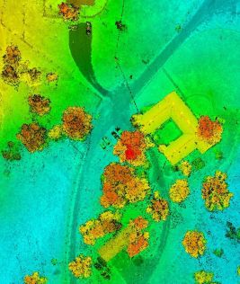
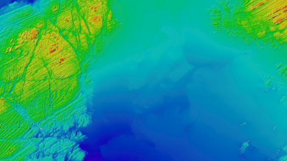
The RIEGL VQ-840-G is a compact Topo-Bathymetric Airborne Laser Scanner especially suited for coastline and shallow water mapping providing more than 2 Secchi depths water penetration. The scanner pro...
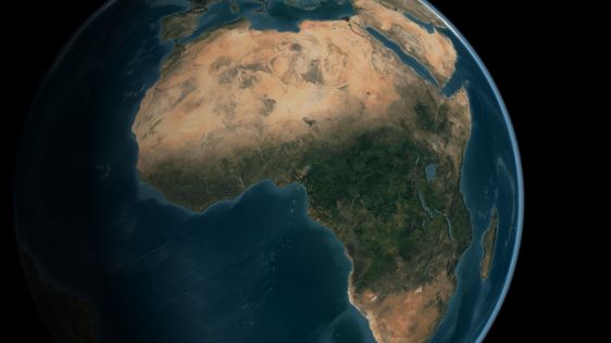
A two-part webinar series entitled ‘Mapping the Seafloor around Africa’ was jointly organized by the IOC-UNESCO Sub-Commission for Africa and the Adjacent Island States (IOCAFRICA) and the Nippon ...
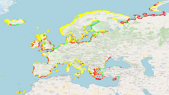
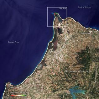
The new EMODnet Geology shoreline-migration map has been released. It is based on field measurements and aerial photography, and covers time periods up to decades. This technique is particularly valu...
The Finnish Geospatial Research Institute (FGI) has recently added the RIEGL VQ-840-G airborne laser scanner to its impressive collection of sensors. FGI innovators are true scientists, moving the 3D ...
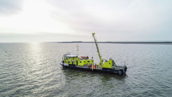
Multiconsult and Argeo have entered into a strategic cooperation to significantly improve the quality of marine surveys and increase construction insight of the seabed conditions for large coastal dev...

Hydro International spoke to five leading experts about the present and future of the hydrographic industry. In this interview, Birte Noer Borrevik (Kartverket: the Norwegian Mapping Authority) talks ...
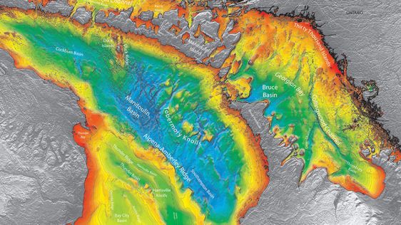
Hydrographic offices (HOs) today exist in a world of accelerating technological change that is influencing human behaviour and creating new needs for and ways of exploiting data to understand our worl...
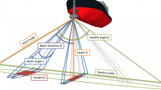
Although the single beam echosounder is still in use, it has over the last 25 years gradually been replaced with new and less expensive multibeam echosounder (MBES) systems. And, although some sidesca...
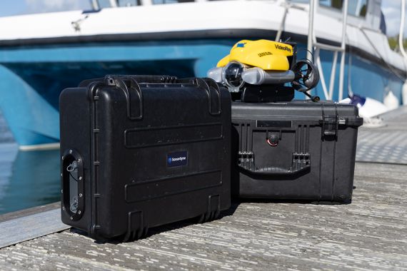
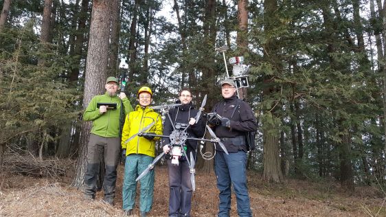
The University of Plymouth is working with a pioneering technology company to develop a revolutionary means of gathering data about the marine environment. The company HydroSurv is developing a range ...
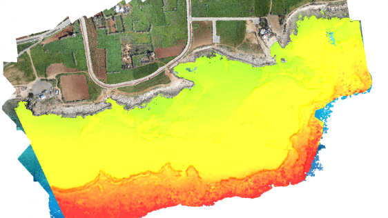
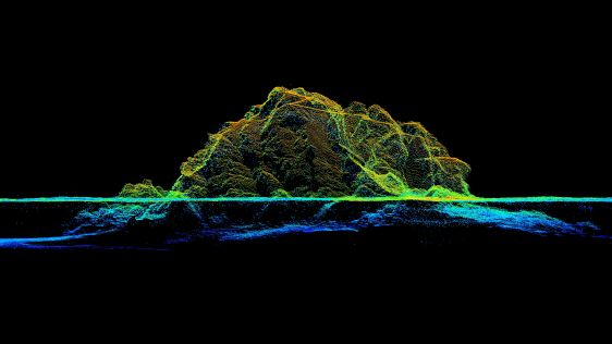
Accurate bathymetric mapping of shallow areas is essential for many offshore activities. Through Structure from Motion (SfM) and Multiview Stereo (MVS) techniques, images can provide a low-cost alter...
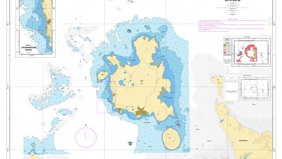
It is widely and wrongly assumed that the world’s coastal regions have been surveyed in detail by modern techniques and that the resulting nautical charts are an accurate reflection of the nature of...
In early July 2020, an OceanAlpha ME120 unmanned surface vessel (USV) joined the national potash mining project in Lop Nur in the Chinese province of Xinjiang to conduct routine bathymetric surveys. L...
The single beam echosounder has come a long way. First developed in the early 20th century in response to the RMS Titanic disaster of 1912, early models used a Fessenden oscillator to generate a sign...
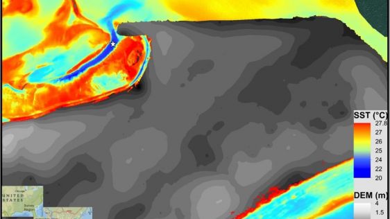
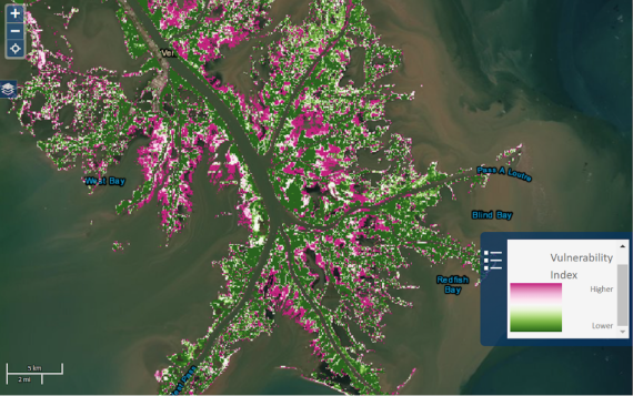
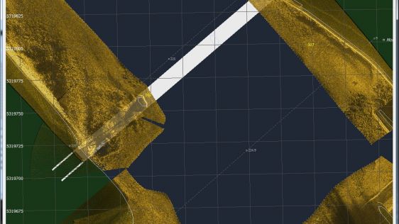
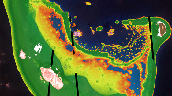
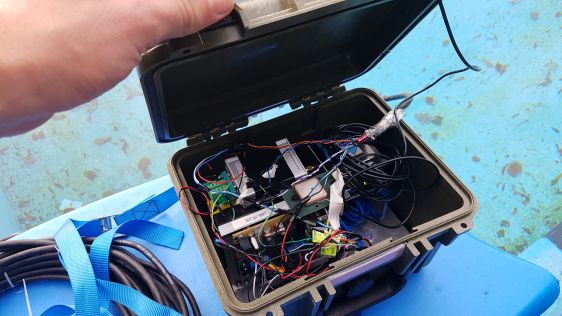
Submarine groundwater discharge (SGD) is a significant part of the water cycle that delivers anthropogenically derived and naturally occurring nutrients to coastal waters. As part of the drive to deve...
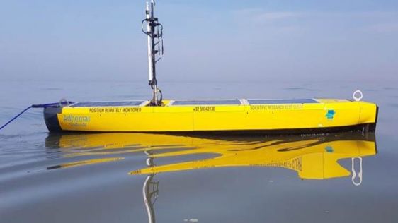
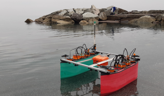
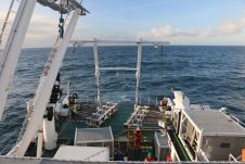
AutoNaut has played a vital role in enabling the Flanders Marine Institute (VLIZ) to seize upon the quiet of lockdown to map the underwater soundscape of the Belgian section of the North Sea. Using it...
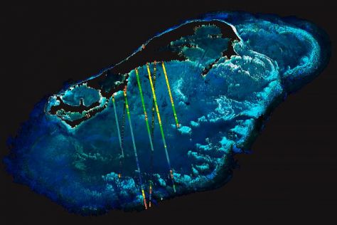
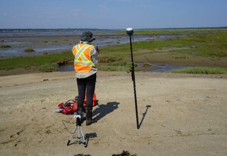
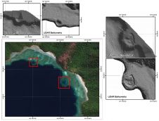
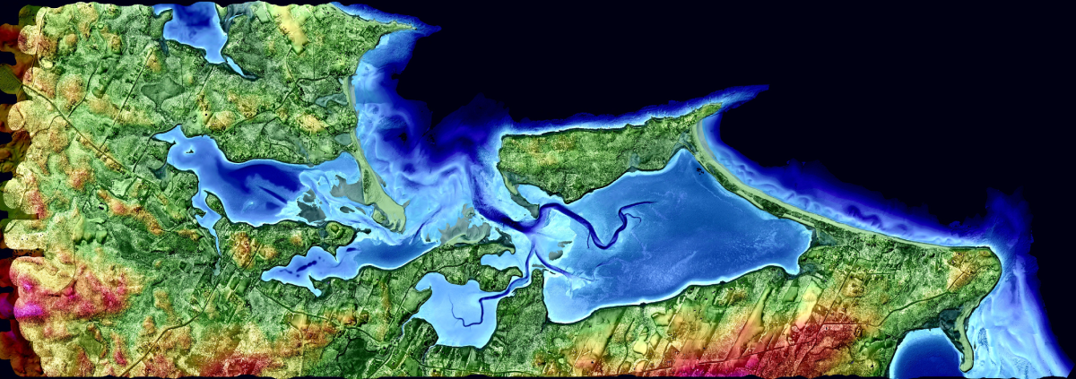
High-resolution bathymetric surveys support aquaculture research and increase navigational safety. In a case study, Tim Webster reports how this is done at Cape John Peninsula in Canada. In a second c...
When the Dutch government and research institutions wanted to monitor how waves and currents would affect the pioneering use of artificial sand banks to protect a levee in a non-tidal freshwater syste...
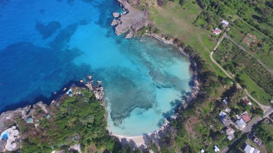
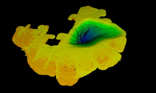
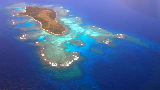
Considered paradise by the legions of tourists who visit each year, the Caribbean islands are developing states that struggle to maintain a delicate balance between economic expansion and environmenta...
TCarta Marine, a provider of marine geospatial products, is commercializing a new technique to derive highly accurate shallow-water bathymetry measurements from NASA’s ICESat-2 satellite data. The n...
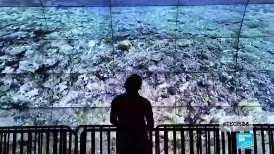
Over 50% of the world’s coral reefs have died over the past 30 years, and up to 90% may die within the next century. To map, record and study these reefs, scientists are now turning to game technolo...
With shallow-water surveys not required to be performed with the accuracy and precision of industrial projects, surveying devices with lower costs are being welcomed by hobbyists eager to determine wa...
This article will immerse you in the deep water of bathymetry. It explains in detail what a bathymetric map is, what it shows, what methods we use to collect the bathymetric data and, last but not lea...
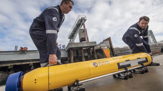
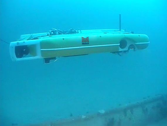
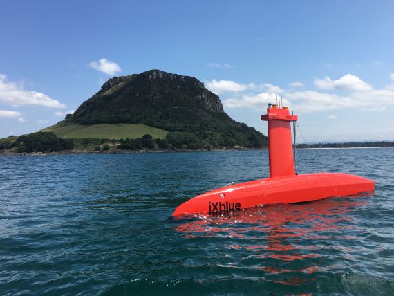
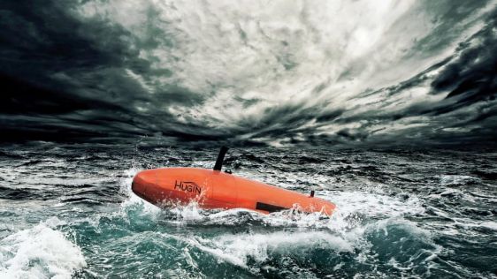
Since the last autonomous underwater vehicle (AUV) review in 2016, the market has continued to grow. The biggest market for AUV systems remains the military. The world’s most advanced Navies own and...
The nearshore and offshore regions running from the shallow coastal shelf to the intertidal zone are dramatic, tempestuous and extremely complex environments that offer the potential to reliably provi...
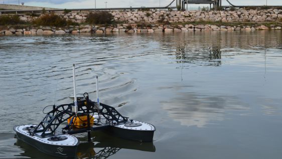
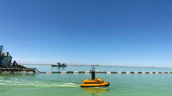
Hydrographic surveying in ultra-shallow, inland and enclosed waters can prove extremely challenging and often presents increased risks and obstacles to both personnel and equipment. These consideratio...
This site uses cookies. By continuing to use this website, you agree to our Cookies Policy. Agree