Hydro International #4 - 2021
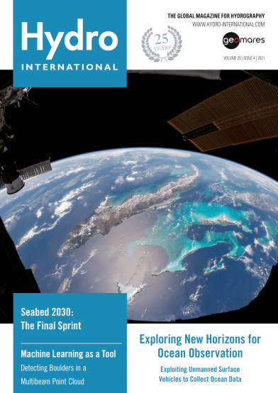
Clouds trace out the islands of the Caribbean Sea in this photo taken by an astronaut from the International Space Station. Beyond the solar arrays and the docked Progress resupply vehicle, the multitoned waters of the Caribbean and the Atlantic Ocean frame the Bahamas, Cuba, Jamaica and southern Florida.
Page 11 - Multispectral Multibeam Echosounder Backscatter Data
Backscatter options in MBES have grown from monospectral using a single frequency to multispectral MBES backscatter data, but what are the benefits of this? This article describes the results obtained during Bachelor’s research project at the Maritime Institute Willem Barentsz in partnership with Deep BV – Hydrography & Geophysics, both in the Netherlands.
Page 14 - Data Quality Factors for Marine UXO Surveys
The detection of unexploded ordnance (UXO) in the sea is a demanding task. UXO survey data are acquired using a set of different sensors in different confi gurations and can span large areas. To make sure that the resulting highly complex dataset is fi t for purpose, a well-defi ned workfl ow is crucial. Researchers of the BASTA project are therefore developing quantitative data quality factors to indicate how survey data should be acquired for the detection of a specifi ed reference object.
Page 19 - Machine Learning as a Tool
Machine learning is currently experiencing a surge of interest. Of course, what fi rst come to mind are self driving cars, face recognition and internet algorithms. However, while these are great examples of machine learning in action, artifi cial intelligence can also be applied for hydrographic purposes. A Bachelor’s research project was carried out at QPS B.V. into the detection of boulders in multibeam point cloud data using machine learning.
Page 27 - Exploring New Horizons for Ocean Observation
As the informed readership of Hydro International knows, the oceans sustain the planet. And, while there are many drivers of the changes to the Earth’s climate that now pose an existential threat to humanity, the health of the oceans is arguably the most important factor for ensuring a healthy climate. There is mounting evidence that the world’s oceans are under increasing stress and that we must fi nd a sustainable way to protect them. An essential element of doing so is making data-driven decisions as to what steps to take to sustain the 70% of the planet covered by water.
Page 32 - The Challenges of Surveying the Faroe Islands
Remotely situated in the northern Atlantic Ocean, roughly equidistant from Scotland, Iceland and Norway, the Faroe Islands form a rugged and rocky archipelago. The cool and cloudy weather, with strong winds and heavy rain possible all year round, means that this is a challenging survey environment. In its search for the best method to capture this stunning environment, the mapping authority has turned to UAVs. This article tells the story of mapping and surveying a truly breathtaking spot on Earth.


