January/February 2020
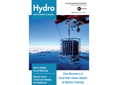
On this cover you can see a picture of the Weddell Sea in Antartica. Onboard the research icebreaker the Polarstern, scientists are deploying a CTD Rosette System to measure oceanographic parameters.
This issue contains the following articles:
- Research Expedition to Map the Scottisch Seabed
- Analysing Mean Sea Level Variations across the Strait of Hormuz
- How a Treasure Map Led Her to the Bottom of the Sea
- Remote, Frozen, Critical and Changing: the Weddell Sea
- Duration at Depth
- Digital Tool to Streamline Hydrographic Information and Make Reporting Easy


