3D Sea Currents of the Channel
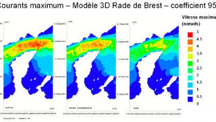
The Service Hydrographique et Océanographique de la Marine (SHOM, France) has made 3D marine currents available at the surface, mid-depth and sea-floor levels. The English Channel is the first area to be covered. The information contains vectorised data on the water levels, the speeds and the directions of the currents, georeferenced maps displaying the current area and maps of the maximum current speed.
SHOM has been developing 3D models of the Channel and Atlantic areas since 2009, satisfying the needs of current data in the entire water column. The 3D models contain additional information about the vertical structure of the current and are interesting to prove shears in the current.
The model has been developed to have a detailed spatial resolution making the SHOM products like maps and predictions more precise and cohesive compared to those based on localised point measures.
The models are available in ASCII, SHAPE and GeoTIFF formats to ensure smooth integration in GIS systems.


