AquaPix Synthetic Aperture Sonar System for DRDC
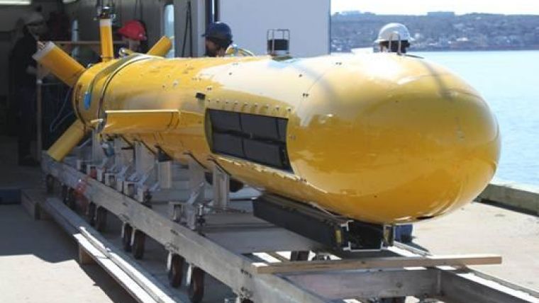
Kraken Sonar Systems, Canada, has successfully completed sea acceptance testing of an AquaPix Interferometric Synthetic Aperture Sonar (INSAS) system for Defence Research and Development Canada (DRDC). Kraken delivered a dual-sided AquaPix INSAS2 system complete with an embedded real-time INSAS signal processing engine and two DataPod removable data storage modules. The CAD500,000 system was integrated into DRDC's Arctic Explorer-class autonomous underwater vehicle (AUV).
DRDC is the national leader in defence and security science and technology. As an agency of Canada’s Department of National Defence (DND), DRDC provides DND, the Canadian Armed Forces (CAF) and other government departments as well as the public safety and national security communities the knowledge and technological advantage needed to defend and protect Canada’s interests at home and abroad.
The sonar system was competitively procured under the Naval Mine Countermeasures project, part of DRDC's Underwater Warfare Programme , which is focused on the use of unmanned systems for naval mine countermeasures. A key transformational technology in this area has been the development of commercial synthetic aperture sonars which provide significant improvements to along-track resolution through the coherent summing of sonar pings as the AUV follows a straight line trajectory. The increased image resolution and quality can provide better input to other parts of the research programme, such as automatic target recognition, battlespace characterisation and marine autonomy.
Kraken’s AquaPix INSAS system provides seabed images with high image resolution and detail. The system leverages the signal processing capabilities and imaging technologies of Kraken's INSIGHT SAS image processing software. Precision sonar imaging techniques sharpen detail and enhance the shadow definition of underwater objects. The image quality improves accuracy and increases confidence in decision-making.
AquaPix is capable of providing seabed imagery with a constant along-track / across-track resolutions better than 3cm x 3cm out to a range of greater than 250m per side of an underwater vehicle (a swath in excess of 500m). It also simultaneously produces 3D bathymetric data with bin resolutions better than 10cm x 10cm and depth accuracy in compliance with IHO special order requirements.
SAS offer high resolution imagery at longer ranges than conventional side-scan sonar. This is done by replacing traditional sonar hardware with signal processing software. The principle of SAS is that the receive transducer array is “synthesized” in software by the coherent recombination of many sonar pings overlapping an area of interest. This represents a major savings in sonar hardware and enables much higher resolution than is possible with conventional sonar.
Interferometric SAS is strongly related to its airborne cousin - interferometric Synthetic Aperture Radar (SAR). While interferometric SAR has transitioned into a commercial off-the-shelf product, interferometric SAS has for a long time remained at the research stage. Some of the reasons for this delay have been the challenges in obtaining very high navigation accuracy through the ocean, as well as the high-computational cost of SAS imaging software. The introduction of stable unmanned underwater vehicles, cheaper and more powerful data-collection and processing electronics, combined with advanced micro-navigation and signal processing software has now brought Interferometric SAS forward as a viable alternative to conventional side scan sonar.
The AquaPix INSAS system provides cost-effective and ultra-high resolution imagery that’s suited for mine countermeasures, surveying sea lanes, cable/pipeline survey, search and recovery operations and a wide variety of other seabed imaging and surveillance missions.
Image: AquaPix INSAS2 system integrated into DRDC's Arctic Explorer AUV.


