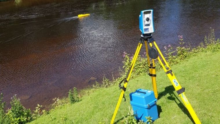
Bathymetric Survey Vessel Tracked with Total Station
To increase public interest and involvement in protecting and improving the Ribble River, which runs through North Yorkshire and Lancashire in northern England, the Ribble Rivers Trust recently commissioned a bathymetry survey of a notable section of the riverbed. A robotically controlled 1.2-metre twin-hull shallow draft vessel powered by a twin jet system was used to survey approximately one hectare of the riverbed. Aboard the vessel was a depth-recording sonar and a tracking prism that enabled a Spectra Precision FOCUS 35 total station to lock onto and robotically follow and record the location of the vessel.
Echo soundings from the sonar were transmitted back to a tablet PC ashore via long-range Bluetooth and time stamped, while the boat’s position was continuously recorded by a FOCUS 35 total station and sent back to a tablet PC also using long-range Bluetooth and time stamped.
The tablet PC ran, 4Site, a programme that formatted and processed the data from the sonar and the total station into a DWG drawing. Each point was positioned in real-time on the screen of the tablet to permit the operator of the vessel to see gaps in the data in real time and navigate the boat back to them to ensure complete coverage.
Airborne Lidar
A mesh of the survey area, a 200-metre section of the 50-metre-wide river with depths to 3.5 metres, was created and combined with aerial Lidar information to produce a topographic survey that was provided to the Ribble Rivers Trust for its education outreach efforts as part of its Heritage Lottery Funded “Ribble Life Together” project.
According to Jack Spees, CEO of the Ribble Rivers Trust the challenge with rivers is that much of the beauty and interest is hidden from view beneath the surface of the water. To reveal this beauty, they undertook a bathymetric survey of a section with particularly interesting features that is adjacent to a heavily used public footpath. The location is a pool at the confluence of the Rivers Hodder and Ribble, known as Hodder Foot. A famous angler (Hugh Falkus) is said to have declared, "If God was an angler he would fish at Hodder Foot". The confluence of these two large rivers creates interesting hydraulic processes that produce notable features, including some surprising depths. It is also home to a range of river species, such as otter, salmon, trout, eel and lamprey. The survey is being used to reveal these hidden depths on interpretation boards, including digitally-augmented reality and video media that will permit visitors to explore the underwater world.


