News
Before and After Satellite Imagery
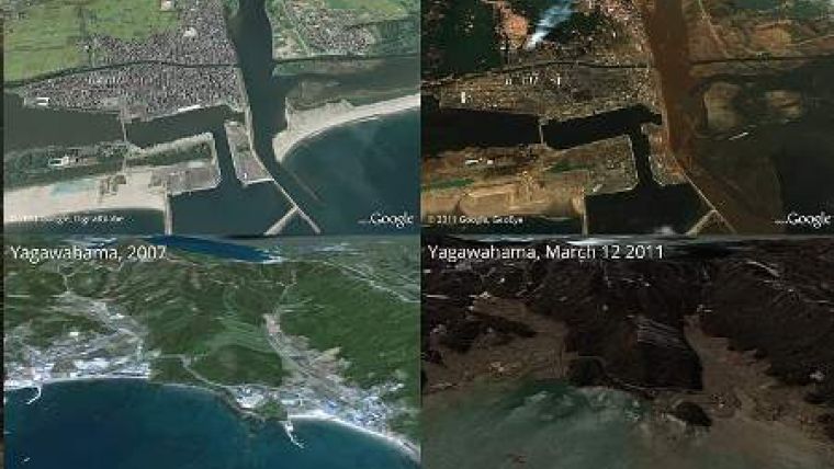
The impact of the catastrophic tsunami that inundated the coast of Japan in the aftermath of the 11th March earthquake is plain to see on comparison satellite images made before and after the disaster.
The images, mostly being sourced from Google Earth and using imagery from various providers, are displayed in several ways such as a slideshow where the recent images are following the older ones and images containing a slider dividing the old and new situation, making the comparison interactive.


