Canada’s Largest Riverine Topobathymetric Lidar Survey Completed
The Greater Montréal Area completed Canada’s largest-ever riverine topobathymetric Lidar survey in response to two major flooding events within the last five years, which together displaced tens of thousands of people from their homes and cost millions to local and regional governments. The survey, which encompassed 1,000 flight lines and a flown length of 10,000 kilometres, will better inform the region’s flood modelling to lower the human and economic costs of future events.
Over the past five years, the Greater Montréal Area has experienced multiple significant flooding events. United within the Communauté Métropolitaine de Montréal (CMM), the Greater Montréal Area brings together 82 municipalities, 4,374 square kilometres, and a population of more than four million people. Located at the convergence point of the Saint Lawrence and Ottawa rivers and with more than 900 kilometres of linear shoreline, Montréal is at significant risk from flooding during periods of heavy precipitation.
Weather Conditions and Topobathymetric Surveys
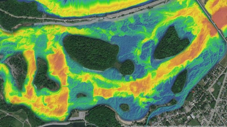
The CMM commissioned NV5 Geospatial to conduct aerial topobathymetric Lidar surveys of the region’s 28 main watercourses, with the goal of updating flood zone mapping and creating an online tool to warn citizens of incoming flooding using high-precision water flow modelling and real-time water-level measurements.
Due to the size of the area and the significant number of watercourses to be measured, the data requested by the CMM represented one of the largest riverine aerial topobathymetric surveys ever undertaken in Canada. Topobathymetric surveys also present unique challenges with regard to data acquisition. The weather conditions must meet a series of parameters: cold enough for leaves to have fallen from the trees, but not too cold for snow to have fallen, and with minimal wind to ensure water clarity. During the autumn season in Montréal, these types of days cannot be taken for granted.


