Casualties of the Nautical Chart
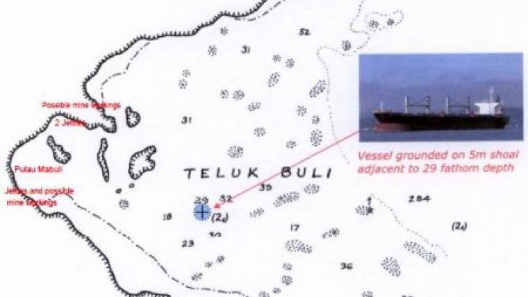
When ships run aground unexpectedly, the initial presumption is that the vessel has struck an ‘uncharted’ feature. However, in practice this is rarely so. A number of chart-related casualties demonstrate that, while no charts are infallible, a better appreciation of their limitations might have averted disaster. New passenger-ship itineraries in tropical seas and Polar regions require especial vigilance. Ever-deeper draught bulk cargo and crude carriers are transiting sparsely surveyed ocean areas and accessing remote locations in the continuing search for and exploitation of new mineral deposits. Are these accidents waiting to happen?
By Ian Russell, UK
Today’s navigators often venture where available hydrographic data does not meet the requirements of contemporary shipping. Member States of the International Hydrographic Organization (IHO) acknowledge this deficiency and are pledged to remedy it; but this will take time. The circumstances leading to past mishaps are therefore potentially present both now and in future. Although the charts in use in some of the cited casualties were compiled from lead-line surveys; they provided ample evidence that less water than charted might be expected. Accounts of accidents often reveal the vessel’s speed to have been excessive in the circumstances.


