Creating Comprehensive Hydrographic Survey Tools
The combination of bathymetry and Lidar provides in-depth data and view of stream quality for aquatic resource managers in Tennessee, USA.
Since its inception in 2015, Skytec has created data-driven solutions to meet clients’ geospatial mapping needs. Environmental work is a major component of Skytec’s offerings, providing a high level of data and detail for clients in land and natural resource management, mitigation projects, environmental stewardship projects, floodplain mapping for municipalities, and more.
With robust data capture abilities through unmanned aerial systems (UAS) and remote satellite monitoring with Planet, paired with the company’s Esri silver partner certification and experience, Skytec delivers a full spectrum of mapping and analysis tools to drive sound decision-making for clients. But how could Skytec’s services be leveraged to capture and complement hydrographic data?
Co-founder and CTO Andy Carroll at Skytec partnered with Trutta Environmental Solutions recently to capture Lidar data as part of Trutta’s High Definition Stream Surveys.
Trutta Environmental Solutions, LLC is an SBA-certified women-owned small business focused on serving the water resources and fisheries communities. The Trutta team developed the High Definition Stream Survey (HDSS) method, a peer-reviewed technique that integrates cutting-edge technology to make stream and river data collection faster, less expensive and more thorough than traditional collection methods.
What is HDSS?
The HDSS method provides water managers with an integrated suite of stream corridor information to support effective decision-making. By employing advances in automation and technology, HDSS enables the continuous collection of geo-referenced imagery with instream, streambank, water quality and bathymetric data over long reaches. HDSS delivers to managers and stakeholders more data, faster, and at lower cost as compared to traditional methods.
As a result, the HDSS platform transforms featureless blue lines on a map into data-rich, one-metre resolution GIS layers representing numerous instream and streambank parameters. These parameters can be combined in informative ways to create powerful decision-support tools allowing for a new holistic approach to river and stream management.
Bathymetry and Lidar: A Collaborative Process
As part of HDSS, the Trutta team collects bathymetric data, or the measurement of depth, in bodies of water. When resource managers along the Duck River in Tennessee sought hydrographic mapping data to analyse a potential drinking water intake location, they turned to Trutta. Trutta Hydrologist and Director of Sales Brett Connell consulted with Carroll and Skytec to innovate an effective method to capture shoreline data.
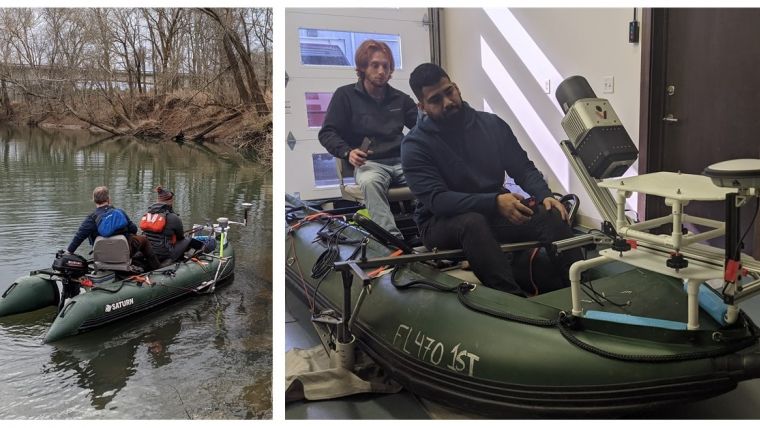
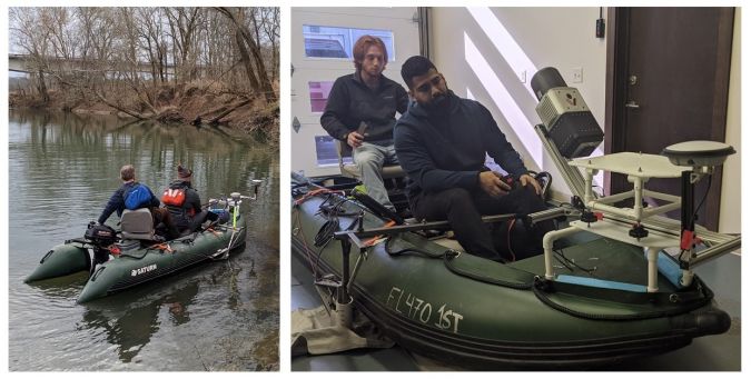
Typically, Trutta uses high-definition video and imagery to capture data; however, this project presented unique challenges. The Trutta team needed specific terrestrial data points to complement the bathymetric data. Given the job site’s particular location, UAS was not an option for this project. Together, Connell and the Skytec team rigged Skytec’s Lidar sensor to one of Trutta’s boats for mapping instead.
“This type of project really enabled us to drive innovative solutions for a client,” Carroll said. “The Trutta team typically builds custom rigs for sensors, and this was no different. Brett and our team built a custom platform for the boat to safely and securely mount the Lidar scanner we typically fly. The results were spot on.”
Novel Solutions for Clients
Trutta operates kayaks and 13-foot inflatable boats; the inflatable boats are nimble and enable operators like Connell to manoeuvre easily in shallow water. By mounting Lidar on the 13-foot boat, Trutta and Skytec captured both bathymetric and terrestrial data that was combined on the back end for a more complete, efficient analysis for the client.
“We typically create assessments from video capture,” Connell said. “By using Lidar as part of our system, we were able to more efficiently capture and model that data and extract usable information for our client.”
Similarly, Carroll said the Skytec team was able to leverage its partnership with Esri to provide 3D modelling components and create robust products to fit the client’s specific needs. “This was a unique project given the constraints,” Caroll said. “Trutta’s project runs parallel with our use of geospatial data – namely, engineering and design work – that made us a strong collaborator on this type of project.”
Both Carroll and Connell agree that this novel solution for clients presents both team’s combined strengths and skills. “This type of work is at the forefront of what we do – providing affordable hydrographic surveys,” Connell concluded. “To be able to combine that with Skytec’s Lidar and terrestrial data shows great potential for ground we can cover for clients.”


