Employing a USV for a Wide-swath Bathymetric River Survey
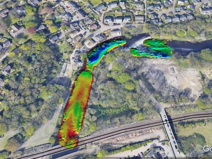
In early spring 2021, Storm Geomatics were approached by an existing client to carry out topographic and bathymetric surveys on the River Aire, in the village of Newlay, to the north-west of Leeds, Yorkshire, in the UK. The survey was required to provide information for local asset recovery works.
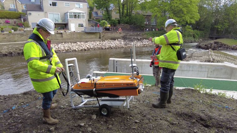
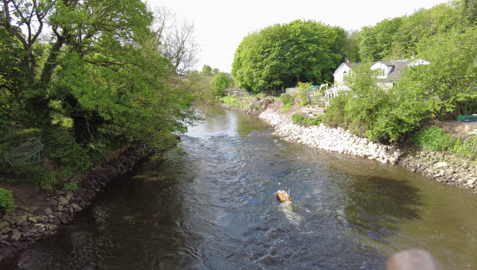
In the extremely shallow river, the system supplied by THURN Group, compromising the OceanAlpha SL40 Unmanned Survey Vessel (USV) equipped with a GeoSwath4 Interferometric Sonar and SBG Ekinox IMU, enabled Storm Geomatics to carry out a full bathymetric survey efficiently and safely in a difficult to access and fast-flowing section of the River Aire.
The 250m stretch of the River Aire surveyed included Newlay Weir, the riverbanks, the foreshore and the flood defences, and was surveyed with no issues due to the USV’s shallow draught and the interferometric sonar’s wide swath, which was able to efficiently survey the river bank-to-bank.
Combining USV and Traditional Survey Methods
The topographic survey was conducted to establish the geometry of the riverbank, foreshore, flood embankments, walls and the ground behind the flood defences. For this part of the work, Storm Geomatics used a combination of the SL40 USV and traditional survey techniques, with a total station capturing a 2m grid and the use of a Trimble SX10 laser scanner. The overlapping parts of the manual and USV surveys were then cross-checked in GIS.
The results of the river survey were combined to form a 3D model, drawings and a hydraulic model in Flood Modeller Pro. This geospatial data delivery informed the engineer of the current topography and conditions at the weir and the model was used to calculate water levels and flow for different rainfall return periods.
THURN Group is a technology development, integration and sales & service company providing systems and expertise to the seabed survey industry, including Polyexplore INS and Lidar, Kongsberg GeoAcoustics, Kongsberg Mesotech and Imagenex sonar systems, OceanAlpha unmanned boats, and UgCS drone-carried lake and river survey equipment. THURN also develops, integrates and sells an expanding range of rotocopter drone- and USV-carried water survey equipment.