Environmental and Bathymetric System
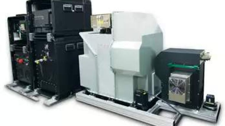
Optech has released the airborne Optech CZMIL Coastal Zone Mapping and Imaging Lidar system, an airborne coastal zone mapping system producing simultaneous high-resolution 3D data and imagery of the beach and shallow-water seafloor, including coastal topography, benthic classification and water column characterisation. According to Optech, CZMIL performs particularly well in shallow, turbid waters. Its bathymetric Lidar is integrated with a hyperspectral imaging system and digital metric camera.
Optech's automated workflow includes an integrated end-to-end software suite, handling all three sensors simultaneously, from mission planning to the production of fused Lidar and imagery datasets.
Optech CZMIL was designed by Optech for the U.S. Government under the auspices of the U.S. Army Corps of Engineers (USACE) and the Joint Airborne Lidar Bathymetry Technical Center of Expertise (JALBTCX). It was built and tested by Optech with the assistance of the University of Southern Mississippi (USM).
Maxime Elbaz, president of Optech, said that the initial results from flight testings provide resolution and depth penetration in shallow turbid waters that have never been achieved before. Optech CZMIL is the culmination of the transition from Lidar instruments to sensor fusion: Lidar, camera and hyperspectral sensor, coupled with a highly integrated single workflow from flight planning to the output of fused data sets. “We already have a solid backlog of orders and expect Optech CZMIL to make a significant impact in the coastal surveying market,” says Elbaz.


