Fugro to Support Climate Change Research in the Caribbean
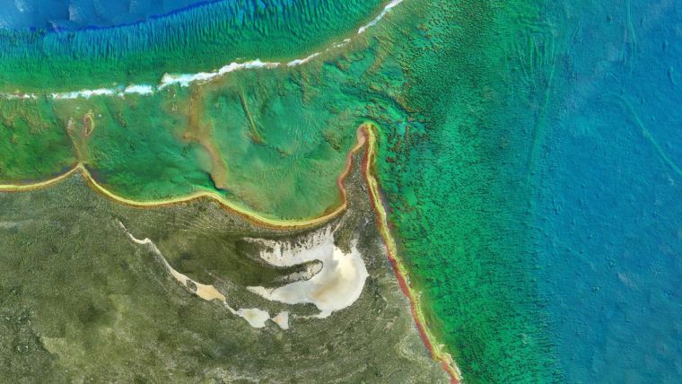
Geo-data specialist company Fugro is embarking on a coastal mapping project in Jamaica and Haiti to support The Investment Plan for the Caribbean Regional Track of the Pilot Program for Climate Resilience. The work, which comprises approximately 2,000 square kilometres of integrated shallow water and land-based elevation data, was awarded to Fugro by the University of West Indies Mona with financing from the Inter-American Development Bank. Fugro will accomplish the project using its Rapid Airborne Multibeam Mapping System (RAMMS).
Reduce CO2 Emissions
Introduced in August 2018, RAMMS delivers depth penetration and point densities for nearshore and coastal mapping. Weighing just 14kg, the compact sensor is deployed on small aircraft with limited support crew requirements. For the Jamaica project, Fugro estimates using RAMMS in place of larger conventional mapping systems will reduce CO2 emissions by 5.1 metric tons, with an overall estimated 80.5% reduction in carbon footprint as compared to a recent deployment in the same region, just 24 months ago.
Multipurpose Use of Data
Fugro is currently operating the system in Jamaica. Once finalized, the data will be used to assess coastal vulnerability and conduct climate analysis related to sea-level rise, storm surges and flooding in the Caribbean.


