Geoscience Voyage Puts Equipment to the Test
Australia's blue-water research vessel, the Marine National Facility's RV Investigator, has returned from her maiden geoscience voyage where researchers took the opportunity to learn more about an ancient reef system off the east coast of Tasmania. In water depths ranging from 90 metres to 3,900 metres, the survey acquired new bathymetry data using multibeam sonar, plus continuous sub-bottom profiles, magnetometer and gravity data. Sampling activities included test deployments of the gravity corer, rock dredge and sediment grab.
Geocience Australia marine scientist Dr Scott Nichol said the main focus of the five-day trial voyage was to undertake test deployments of geoscience equipment and to opportunistically collect physical seabed samples on the outer shelf and continental slope to the east of the Freycinet Peninsula.
A particular focus of the voyage was a series of known reefs and submarine canyons within the Freycinet Commonwealth Marine Reserve. Dr Nichol explained that the trial voyage built upon previous work by Geoscience Australia and the University of Tasmania that first discovered these reef systems in 2008.
Dr Nichol explained that from initial analysis of the dredge and grab samples collected, it appears the ridges are covered in soft carbonate-rich sediment to a thickness of at least a metre and may have an inner core of hard substrate.
The survey provided the team an opportunity to collect and process physical core samples using the RV Investigator's laboratories. Collected from sites on the continental slope, the cores provided insights into the sedimentation history of the Australian margin, with preliminary inspection suggesting a history of gravity-driven sediment transport down the slope.
The voyage also achieved the deepest ever deployment of an Ocean Bottom Seismometer (OBS) in Australian waters. The team successfully deployed and recovered two OBS instruments in 3,500 metres water depth, far deeper than previous maximum deployments of 2,400 metres. In addition to providing valuable training for the crew in handling the OBS units, the instruments recorded a magnitude 7.1 earthquake in Papua New Guinea that occurred on 1 May, clearly demonstrating their sensitivity.
With a team of 25 geoscientists and technical specialists on board, the voyage provided a rare opportunity to build new networks, exchange ideas and discuss opportunities for future collaborative projects using the RV Investigator.
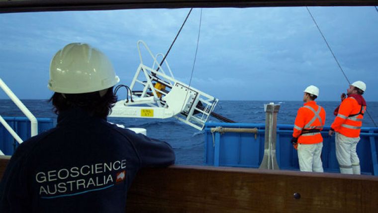
Image: A gravity corer being deployed during the RV Investigator trial geoscience voyage during May 2015. Image courtesy: Marine National Facility.


