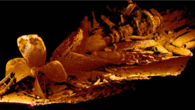
High-resolution Underwater Scan of Monohansett Shipwreck
The National Oceanic and Atmospheric Administration (NOAA) used 2G Robotics’ ULS 500 underwater laser scanner in 2014 to explore the Monohansett shipwreck site at the Thunder Bay National Marine Sanctuary, USA. The scans generated by the ULS 500 provided 3D archaeological records of the site in its current condition and provided a more detailed understanding of the wreck.
Obtaining detailed information of shipwreck sites is critical for generating accurate historical records. Photography and videography can capture imagery of underwater archaeological sites. However, wiith underwater laser scanning, accurate dimensional information of archaeological sites can be captured for the creation of highly detailed historical records.
The Monohansett was a wooden freighter built in 1872. In November 1907, she succumbed to an engine room fire and sunk to the bottom of Lake Huron.
Image: 3D image of the Monohansett.


