How to Predict the Drift of Oil Slicks
Forecasting the behaviour of an oil slick and predicting where and when it will reach the coastline is crucial for organizing an efficient emergency response. A study led by CMCC Foundation’s researchers, based on the case study of the 2018 oil spill accident off Corsica, demonstrates the effectiveness of the MEDSLIK-II oil spill model, which they developed for predicting an oil-beaching event.
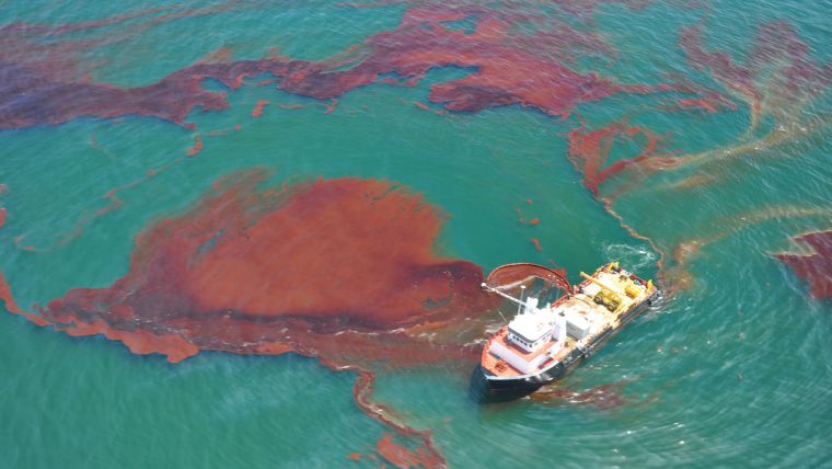
What Happened?
In October 2018, the Tunisian Ro-Ro passenger ship Ulysse rammed into the hull of the Cyprus-flagged container ship Virginia, which was anchored in international waters off the northern tip of Corsica, an area known for its pristine waters and beaches. Bunker fuel from the Virginia leaked out of her tanks through a breach several meters long, threatening the marine environment and coastal areas. 530 m³ of oil were released, and in 36 hours the slick had lengthened to cover approximately 35km. Predicting the drift of oil slicks on water surfaces and in coastal zones is fundamental for responding to spill events and mitigating their impacts on the environment, allowing for the more efficient use of emergency response resources.
A recently-published scientific paper describes the collaboration that was formed for this purpose, between the researchers of the CMCC Foundation (Euro-Mediterranean Center on Climate Change) and REMPEC (Regional Marine Pollution Emergency Response Centre for the Mediterranean Sea), based in Malta, right after the collision.
Observational Data
"Thanks to a joint effort involving the efficient and timely exchange of information, we received observational data from REMPEC and used these real observations as the starting point for our model in order to calculate the forecast", explains Svitlana Liubartseva, a researcher at the CMCC Foundation and first author of the study. "We worked day and night, and provided REMPEC with five forecast bulletins during the oil spill tracking and recovery operations."
Forecasts of currents, wind, waves and sea surface temperatures are critical for predicting the spread and fate of oil. The study focuses on the ability to realistically predict the times and places where the oil reaches the coastline, using the oceanographic model MEDSLIK-II developed by the CMCC Foundation. The model results were verified by comparing available observational data.
Copernicus Marine Environment Monitoring Service
"Using the oceanographic and atmospheric data set provided by the Copernicus Marine Environment Monitoring Service (CMEMS) and the European Centre for Medium-Range Weather Forecasts (ECMWF), we produced forecasts of the oil drift. The CMEMS output has a high resolution of about four kilometres, that allowed us to produce a rather good quality of prediction of when and where the oil reached the beaches", specifies Dr Liubartseva.
For the first 16 days after the accident, the model was able to generate reliable predictions, forecasting the oil movements at least 7 days in advance. Researchers were able to predict almost precisely the place and time where the oil would reach the coast for the first time. After more than 9 days drifting at sea, it landed near Saint Tropez (France). Due to a lack of observational data in the long term there was a deterioration in the model solution, as the oil drifted for about one month. Nevertheless, the research demonstrates that the CMCC model facilitates the use and optimization of anti-pollution resource deployment and increases coastal preparedness.
CMCC researchers are now working on improving the predictability of oil spill drift and transformation. They aim to improve the resolution of the models, making their grid finer and finer, which will involve studying more oil spill events to obtain better predictions.
Marine Pollution Bulletin
For more information, read the article: S. Liubartseva, M. Smaoui, G. Coppini, G. Gonzalez, R. Lecci, S. Cretì, I. Federico: Model-based reconstruction of the Ulysse-Virginia oil spill, October-November 2018. Marine Pollution Bulletin, Volume 154, May 2020, https:/


