Hydrographic and Geophysical Surveys in Celtic Sea and Atlantic Ocean
Hydrographic and geophysical survey operations will be undertaken by INFOMAR in the Celtic Sea and the Atlantic Ocean between April and October this year, according to a recent marine notice from the Irish Department of Transport, Tourism and Sport. INFOMAR is a joint programme between Geological Survey Ireland and the Marine Institute, surveying unmapped marine territory and creating a range of integrated mapping products of the physical, chemical and biological features of the seabed.
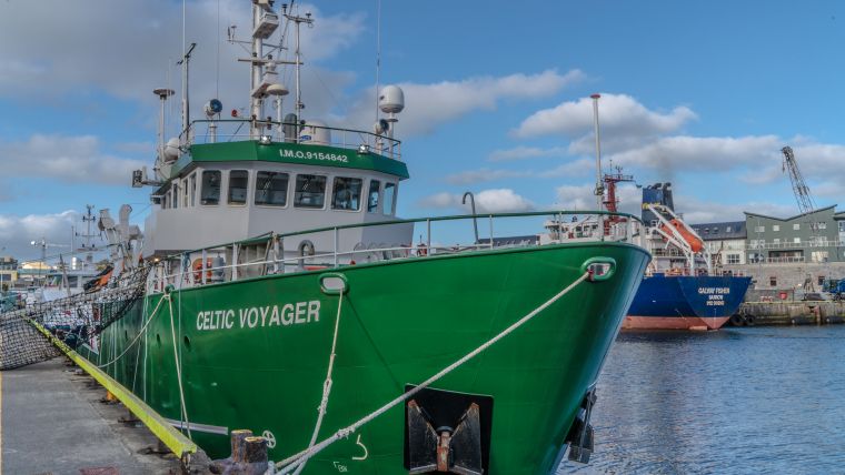
Covering some 125,000 sq. km of underwater territory, INFOMAR will produce integrated mapping products covering the physical, chemical and biological features of the seabed. Both Irish Marine Institute vessels, RV Celtic Voyager and RV Celtic Explorer, will be employed for these survey operations, towing a magnetometer sensor with a single cable of up to 200m in length and a moving vessel profiler cable of variable length up to a maximum of 200m. Geological Survey Ireland will also operate four vessels, RV Keary, RV Geo, RV Mallet and RV Lir.
All vessels will display appropriate lights and markers and will be listening on VHF Channel 16 throughout the course of the survey.
Photo courtesy William Murphy.


