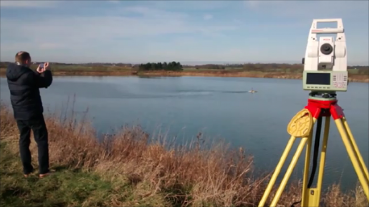
Use of Total Station with HyDrone Demonstrated
Leica (Switzerland) recently introduced the latest version of its TS16 robotic total station together with its accompanying VIVA controller and tracking software. SCCS demonstrated this system, tracking the HyDrone remote control vessel (RCV) and HydroLite echosounder combination at a recent event on a lake near its head office in Cambridgeshire, UK.
The HyDrone system is a remote radio controlled survey platform suitable for hydrographic surveys when combined with the HydroLite portable echosounder and a positioning system. Ruggedly constructed, the HyDrone and frame are made from high-quality marine components offering a lightweight stable platform based on its twin hull catamaran design. The HydroLite component of the system is a combination of the Ohmex SonarMite portable echosounder with a rugged clamp mounting and detail pole. The HydroLite detachable frame provides support for the echosounder, detail pole and either a robotic EDM prism or a GPS antenna depending on the required configuration. An important feature of the system is that the same positioning equipment and software are used throughout enabling seamless integration of both hydrographic and conventional land survey data of the surrounding catchment area.
The VIVA control unit has an improved Bluetooth radio enabling direct reception of the SonarMite's depth data transmissions at ranges of up to 250m. The TS16 total station automatically and continuously adapts for best measurement performance to a variety of site conditions such as rain, fog, dust, sun, heat shimmer and reflections.
River Modelling
There is a demand for accurate hydrographic data as source input to hydraulic river modeling software used in support of flood risk management and other hydrological risk assessment criteria. These modeling needs cover a wide range of flood risk management activities including planning, strategy and flood risk mapping. The data is used to build ground models for the appraisal and design of flood alleviation schemes including the ongoing operation and maintenance of rivers, streams and channels. With the recent extensive flooding in the UK it has become imperative to produce accurate hydrographic data for planning the hydrological modeling, realignment and maintenance of rivers together with their surrounding environment, particularly in urban areas. Shallow water hydrographic surveys on inland waterways present unique challenges for data capture with overhanging tree canopies, bridges, siltation and vegetation presenting obstacles to gathering accurate data in a dynamically changing environment. Conventional positioning technology using GPS is well suited to open water situations such as estuaries, lakes and reservoirs whereas robotic total stations present a practical solution to surveying in narrow rivers and streams.
Commenting on the results of a similar trial by Acorn Surveys, Dave Bulmer stated the system was rugged, easy to use and fit for purpose. The trial results presented hydrographic data of the highest quality. Further trials are planned for testing the tracking system using the Zeno 20 portable GPS and the advanced Leica scanstation, the latter should result in hydrographic data combined in a point cloud of scanned topography including river banks and structures.


