News
Interactive Oil Spill Map
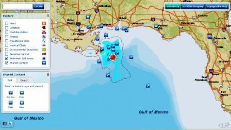
ESRI has created an interactive map containing various sources of information related to the Deepwater Horizon oil Spill near Louisiana, USA. The map indicates the oil areas on the Gulf of Mexico. Optionally, more information can be added to the view.
The user can choose to see web links, news, videos, photos and Twitter postings around the area. The map gives an indication of sensitive areas, threatened sites and information about the sensitivity of the coastal zone.
The users also can add their information to the map in order to be shown.


