IXSEA Equips UMass in Search for Niagara Wreck
The U.S.S Niagara, a steam-run and sail-powered frigate launched in 1856 and commissioned in 1857, was a part of the Civil War northern blockading fleet and escort, which also played a role in helping to build the first transatlantic cable. With the arrival of new steel-hulled frigates, the Niagara was retired, stripped of most of its armament, and scuttled in 1897 in Boston Harbor.
Now, over a hundred years later a team from the University of Massachusetts (UMass), Boston, led by Professor Allen Gontz, coastal geologist and geophysicist, in collaboration with Vic Mastone, the state underwater archaeologist and the Massachusetts Board of Underwater Archaeological Resources has set out to locate and eventually preserve this wreck. The overall objective is to have the site designated as an underwater archaeological preserve and listed on the national historic registry.
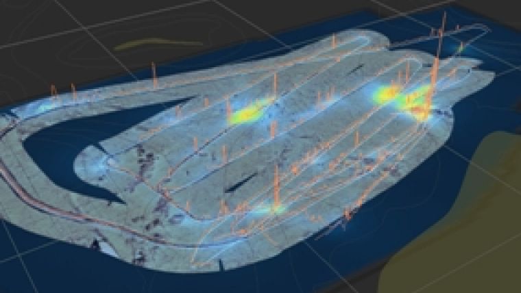
A site that holds high potential for wreck was located in Boston Harbor by a range of geophysical and geological tools including IXSEA’s MAGIS magnetometer, a sidescan sonar and sub-bottom profilers, which respectively detects the presence of metal in the wreck, produces an image of the seafloor and penetrates through the seabed to reveal sedimentary sequences using sound.
MAGIS, a high resolution, high speed data collection marine magnetometer detects metallic objects on the seafloor or buried in the sediment and using Dynamic Nuclear Polarisation (DNM), it measures the earth magnetic field and its variations (mines, shipwrecks, cables, containers localisation, archaeology), in this case the wreck of the U.S.S. Niagara. The RV Looney, the vessel used to locate the wreck used the MAGIS as a towed system which is both easily deployed and completely adjustment-free.
To date, MAGIS has been used for a range of applications from mapping of buried objects, to pipe and cable route survey and even mine hunting. Used in conjunction with IXSEA’s DELPH MAG LOCATOR, it is a real-time and batch objects mapping tool with magnetic filtering, producing 2D magnetic field intensity maps in real time.


