Leica Chiroptera II Substantially Exceeds Depth Specs
Airborne Hydrography AB, part of Leica Geosystems, recently set a new depth record in airborne Lidar bathymetry with the Leica Chiroptera II system. The Leica Chiroptera II, which is specified for a maximum depth of around 15 metres, unexpectedly achieved 31 metres depth during a customer demonstration survey near Okinawa and the Tenryu River, Japan.
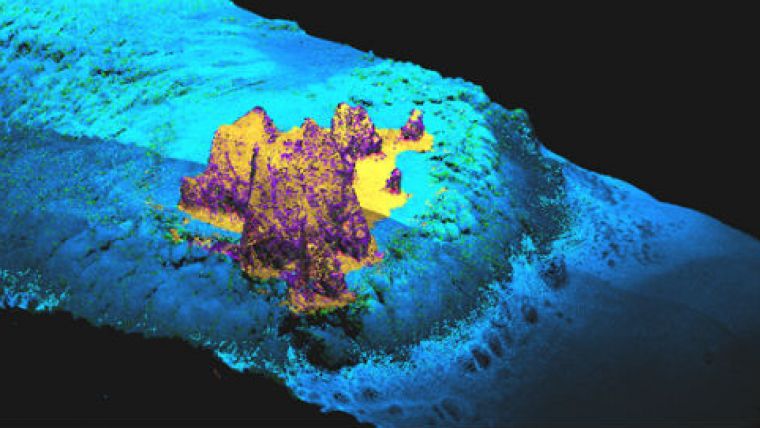
Airborne Hydrography AB has conducted customer demonstration surveys in Japan using the Leica Chiroptera II and Leica HawkEye III airborne Lidar systems. The Chiroptera II system is a combination of both topography and a bathymetry Lidar, designed for use in near-shore surveys and surveying in coastal areas.
During the survey of the Tenryu River, results were achieved with the HawkEye III showing a highly detailed profile of the complex river structure. The data include highly accurate bathymetric data as well as terrestrial data, which deliver a seamless land and river floor topography. The data are used for environmental monitoring and allow to observe and analyse the changes of the river bed over time.
The HawkEye III, a multi-sensor Lidar with a maximum depth range of approximately 50 metres, was also used in the Okinawa demonstration and has proven its specs.
In both demonstrations the Chiroptera II and HawkEye III systems further proved their excellent capabilities in difficult turbid water conditions. The HawkEye III system was the first Lidar system to successfully collect data in turbid Japanese river environments.


