Mapping Underwater Habitat
Biosonics’ Visual Habitat DT-X is a software product for the rapid assessment and mapping of aquatic habitat features. With Visual Habitat software, users can present information in a clear and visually captivating display. DT4 data files can be processed to generate full colour maps displaying transects as data layers highlighting bathymetry, plant coverage, plant canopy height and substrate type.
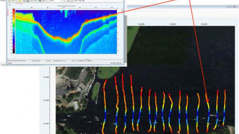
When viewing each file echogram, simultaneously the synchronised transect map view can be monitored. This dual-viewing mode of Visual Habitat DT-X allows for visual ground truthing of a plan (map) view with a cross-section (echogram) view.
An integrated utility automatically provides satellite imagery of the study site over which habitat data can be superimposed. Data can be processed and maps generated within minutes of data collection, all with very little training. User-selectable colour gradients allow for easy identification of substrate types such as rock, mud, sand as well as plant density and height. The output is a visual representation of results that can be interpreted, shared, and communicated. Processed files can be exported as .CSV for GIS mapping or as .KML files for sharing and viewing via Google Earth.


