Meeting the Challenge of High Latitude Navigation
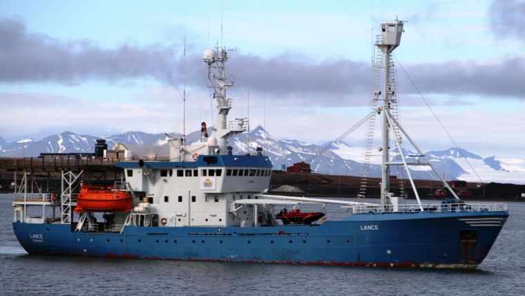
When conducting a routine mission to recover scientific instruments, the Norwegian Polar Institute recently offered iXBlue live Arctic testing of its products. At high latitude (North), the biggest problem is to determine the correct heading without bias. Thanks to its precision, iXBlue Phins consistently delivered performance similar to that achieved at lower latitudes. Furthermore, iXBlue gyroscopes, compensated for thermal behaviour, maintained performance even when mounted on the exterior of the vessel.
iXBlue FOG has also been put to harsh real-world subsea test where GPS aiding is not available. The high latitude test was conducted onboard the International Submarine Engineering Arctic Explorer class AUV. This equipment was selected to support the ‘Cornerstone’ project performed in conjunction with NRCAN/DRDC. The goal was to develop the equipment and methodology necessary to collect high-resolution, hydrographic-quality, bathymetric data of the Arctic seabed in harsh weather conditions. UNCLOS Article 76 survey missions were conducted with an AUV under the ice and a full acoustic positioning solution including iXBlue PHINS to track it. According to James A.R. McFarlane at ISE, during testing, iXBlue PHINS operated as predicted over two arctic deployments and the navigation performance was up to the expectations.
Fiber Optic Gyroscope technology occupies a unique place in the navigation history. FOG continues to break performance boundaries where other gyroscope technologies have reached their limits. iXBlue FOG and INS technologies deliver exceptional and reliable performance, required by extreme maritime applications such as high latitudes (North) navigation, nuclear submarine stealth operation as well as mission critical space applications.
iXBlue’s system performance is repeatedly proven in many arctic missions, under the Canadian’s ice and in the Norwegian seas. Navigation in the northern latitudes is difficult mainly because of the alignment. The physical effect that is measured for the alignment is the projection of the Earth’s rotation rate on the horizontal plan. The higher the latitudes, the more difficult it gets to accurately project where North is.
Image: The Lance vessel equipped with iXBlue’s inertial navigation systems.


