NaviModel DTM Software
NaviModel software for ocean mapping, data analysis and interpretation provides intuitive 3D visualiasation of infinite survey data sets by import of multiple data formats and sources using user-defined templates. NaviModel includes features for data cleaning either manually or through use of advanced semi or fully automated tools as well as creation of own filters by use of plug-in function.
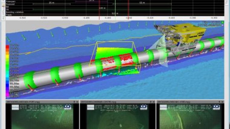
Digital terrain models (DTM) are displayed in real-time fly-through fashion featuring different color modes and palettes in addition to adjustment of light source. Difference models and volume calculations are visualised by colouring the resulting DTM in difference modes. Terrain manipulation is performed by levelling out depth differences between lines by skewing lines toward an average surface representation. Special pipe line modelling capabilities comprise pipe and flag editing in real-time 3D environment and support of export formats including SITRAS through user defined templates. NaviModel further provides special facilities by which it is possible to match DTM, video and events and thus visualize run-line, ROV track, pipeline, flags, events and DTM all in the same 3D environment. Moreover NaviModel provides tools for automatic export of data in terms of shaded reliefs, soundings, contours, bathymetry, longitudinal and cross profiles, etc. as well as export directly to AutoCad supporting content in relevant layers.


