New Seamount Discovered During ECS Mapping
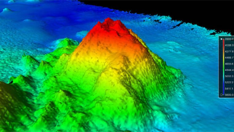
A discovery has come out of the U.S. Extended Continental Shelf (ECS) Task Force mapping efforts in an area of the Pacific Ocean that is one of the least explored of the Earth's oceans. On 13 August 2014, University of New Hampshire (UNH) Joint Hydrographic Centre (JHC) scientists aboard the R/V Kilo Moana, discovered a new seamount in the Pacific Ocean using a 12kHz multibeam echosounder. The seamount, estimated to be more than 1,100 metres high, was discovered in the midst of a feature-rich stretch of seafloor approximately 5,100 metres deep.
The scientists, led by Dr. James Gardner, have been mapping the ocean floor since 8 August. Seamounts are typically formed from extinct, submerged volcanoes, and can be found in the ocean around the world. The as-yet-unnamed seamount is located about 300 kilometres southeast of Jarvis Island, in the South Pacific Ocean.
Seamounts often support diverse communities of marine organisms, including commercially and ecologically important fish species, due to their high relief and their effect on localised ocean currents.
The ECS Task Force is a multi-agency body that directs and coordinates the ECS Project, which is an effort to delineate the U.S. continental shelf beyond 200 nautical miles. NOAA is one of the co-vice chairs of the task force. In the course of the ECS effort, discoveries like this seamount are surprisingly common.
When this project was added to the President’s budget in 2008, NOAA’s Office of Ocean Exploration and Research (OER) assumed the agency’s annual funding and project coordination responsibilities. OER routinely works in conjuction with NOAA’s Office of Coast Survey and UNH/JHC to carry out the bathymetric mapping for this project.
The UNH JHC is a formal cooperative partnership between the University of New Hampshire and NOAA's Office of Coast Survey. Its aim is to create a national centre for expertise in ocean mapping and hydrographic sciences.
Image: Three-dimensional view of the southwest side of the seamount with 23-degree slopes. Image courtesy: Center for Coastal and Ocean Mapping/Joint Hydrographic Center.


