NV5 Geospatial maps over 10 million hectares of North America's coastline and rivers
A decade after completing its first shoreline mapping project, NV5 Geospatial has mapped over 10.5 million hectares of North America’s shoreline and riverine environments for more than 200 projects. These projects have covered areas from the Nuyakuk River in Alaska to the Florida Keys, including Lake Tahoe in California, the Rio Grande in Texas, the coasts of South Carolina and North Carolina, Achigan River in Quebec and Chesapeake Bay in Maryland.
In 2022 alone, the company acquired topobathymetric Lidar data for 14 projects, such as the Yellowstone River in Wyoming, Hells Canyon in Indiana, Revillagigedo Island in Alaska and Iles de la Madeleine in Quebec.
In 2023, NV5 is set to undertake further shoreline and riverine projects, including a two-year contract with the National Oceanic and Atmospheric Administration’s (NOAA) National Geodetic Survey to provide topobathymetric Lidar, 4-band imagery and mapping of 8,054km2 of the coastal Maine shoreline.
Topobathymetric Lidar
According to Kurt Allen, vice president of NV5 Geospatial: “For a decade, we have been helping local, state and government agencies as well as commercial and private entities gain the insights they need to solve some of their most challenging nearshore and riverine projects through our mapping technologies including topobathymetric Lidar. We are constantly improving our technology and scalability to always be ready for our customers, whether it be mapping the shoreline after a hurricane, updating the national shoreline, assisting water boards with flood planning or other possible use cases.”
In 2012, NV5 Geospatial mapped shorelines and riverine environments for the first time using high-resolution bathymetric Lidar and natural colour imagery for 13,765 hectares of shoreline along the Sandy River in north-western Oregon to study the ever-changing basin geomorphology. Today, topobathymetric Lidar has a wide range of use cases, including shoreline and coastal intelligence, habitat restoration, floodplain modelling, volumetric analysis, infrastructure planning and engineering and coastal zone management.
Topobathymetric Lidar uses airborne laser-based sensors to measure and record three distinct surfaces – land, water and submerged land – simultaneously. While it shares some characteristics of traditional airborne Lidar mapping, it has significant differences that enhance understanding of the nearshore environment for improved marine resource mapping, benthic habitat mapping, shoreline delineation, nautical charting and marine debris mapping.
Hurricanes, flood control and flow regimes
The following five projects provide a sampling of the work NV5 Geospatial has participated in over the last ten years:
- Hurricanes Michael, Florida and Florence, North Carolina. In the aftermath of hurricanes Michael and Florence in 2018, NV5 Geospatial was tasked by NOAA to conduct shoreline mapping (topobathy Lidar, 4-band imagery, shoreline compilation) for nearly 20,730 square kilometres, spanning the entire coast of North Carolina and the panhandle coast of Florida. Data from this effort is being used to update the national shoreline, improve inundation models and for numerous coastal management applications.
- Okanagan Lakes, British Columbia. NV5 Geospatial collected topobathymetric Lidar and 4-band imagery data over a 573 square kilometre area of the Okanagan Lakes in south-eastern British Columbia. The data collected is being used to assess nearshore bathymetry to support community planning and policies for flood control.
- Elbow River, Alberta, Canada. NV5 Geospatial collected topographic Lidar data over the Elbow and Bow Rivers located in the city of Calgary, Alberta. The area of interest included a 74-kilometre reach of the Bow River and a 24-kilometre reach of the Elbow River including its confluence with the Bow River. The City of Calgary will use the data for emergency management and flood mitigation engineering and to support environmental rehabilitation projects.
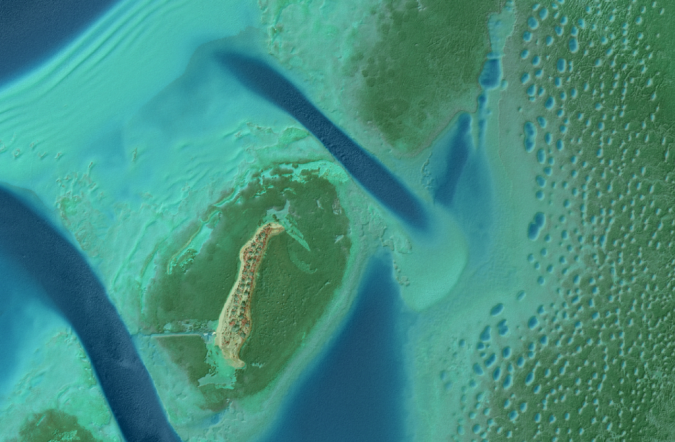
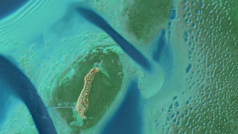
- Florida Keys, Florida. NV5 Geospatial collected topobathymetric Lidar data and 4-band (33cm GSD) digital imagery over 5,509 square kilometres of the Florida Keys impacted by Hurricane Irma in September 2017. The data was collected to support NOAA in mapping and updating the national shoreline.
- Platte River, Nebraska. NV5 Geospatial has been awarded two four-year high-resolution Lidar and orthoimagery (15cm GSD) data collection contracts for repeated collections among seasons and years along a 160-kilometre reach of the Platte River in central Nebraska. The data will aid Headwaters and the Platte River Recovery Implementation Program in monitoring and understanding the impact of flow regimes on channel morphology and listed species habitat throughout this dynamic river system.