Operation Gooseberry Surveyed and Mapped
The entire QPS/IVS 3D suite of software products will be used during Operation Gooseberry (the survey of the British and Canadian D-Day beaches). QPS QINSy hydrographic software will be used for the collection of the survey data from the multibeam system and the magnetometer. Geo-spatial data processing will then be performed by IVS 3D Fledermaus software on the bathymetry data.
Fledermaus will also be used to process the multibeam backscatter data, for processing the water column data (which will be collected over the wrecks) and to overlay the magnetometer data onto the bathymetry to aid in the search for the mooring anchors. Fledermaus scenes will then be created for people to download and view with iView4D, the free viewer. ESRI ArcGIS deliverables will be created for all of the data types by the seamless data transfer from Fledermaus to ArcGIS.
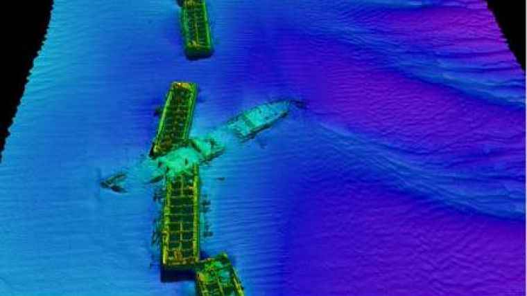
Image: From the previous Center for Coastal and Ocean Mapping (CCOM) , UNH survey that was performed on the US D-Day beaches. Image courtesy: the Underwater Archaeology Branch of the Naval Historical Center, Reson Inc. and the University of New Hampshire's Center for Coastal and Ocean Mapping/Joint Hydrographic Center.


