Optech at MAPPS 2014 Summer Conference
Optech, Canada, is the official sponsor for the MAPPS Golf Tournament at the MAPPS 2014 Summer Conference, to be held from 27 to 31 July 2014 in Coeur d’Alene, Idaho, USA. This year’s Golf Tournament is taking place on Wednesday, 30 July at the scenic Coeur d’Alene Golf Course, known for its unusual 'floating' green on the 14th hole in the middle of the lake. During the conference, Optech president Max Elbaz will join a panel to discuss the many applications of bathymetric/topographic Lidar systems and data (from 11:00 a.m. to 12:00 p.m. on Tuesday 29 July).
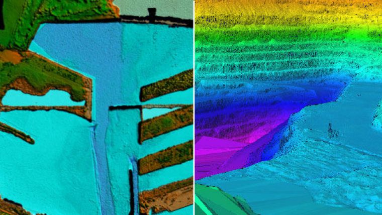
Foremost among these Lidar systems is the Optech CZMIL, which is in use by several government agencies, some of whom will have their own representatives on the panel. By penetrating 80 metres deep in clear conditions and mapping bathymetry in turbid and muddy-bottomed waters, CZMIL opens the door to a wider variety of applications. The CZMIL HydroFusion software workflow also provides productivity by automatically fusing the data from CZMIL’s Lidar, hyperspectral and RGB sensors to create an extensive list of deliverables beyond what is possible with other systems.
The conference attracts firms involved in surveying, spatial data and GIS from all over North America to discuss matters of industry-wide importance. Optech will be there to share a new application for integrating small UAVs with terrestrial Lidar, and highlight the growing importance of airborne Lidar bathymetry.
The golf tournament is in a scramble format open to members, guests and spouses of all skill levels, so if you wish to enjoy the beautiful course and network with fellow professionals, remember to register before the cut-off date of 27 July.
During the conference, Monday 28 July will be dedicated to discussing how to employ small UAVs for surveying, including the legal and technical hurdles users may face. One of the more recent developments in this field is the combination of ground-based lidar, supplemented by close-range UAV stereo photogrammetry. This combination of sensors allows surveyors to capture high-resolution 3D Lidar point clouds from the ground, fused with aerial 3D point clouds generated from the UAV stereo pairs, to produce complete models without holes, shadows or gaps. Optech’s partner geo-konzept recently proved the efficiency of this approach by combining an Optech ILRIS terrestrial laser scanner and their own geo-X8000 UAV in a recent project in Germany, significantly cutting the time needed for the survey.
Image: Optech CZMIL Topo-Bathy and ILRIS 3D models.


