Optech Celebrates 40 Years of Lidar Innovation
Optech is celebrating 40 years of Lidar technology innovation. To mark the milestone, Optech is paying tribute to the incredible partnership with its clients over the years, from the first commercial Lidar systems in the world to solutions for bathymetry and UAVs. A celebratory event was held at Niagara Falls, including an exhibition of projects and the evolution of Optech Lidar technology that has supported clients over the last 40 years.
Lasers were barely out of their infancy in the late 1960s, yet founder Dr Allan Carswell saw their potential for revolutionising remote sensing and began developing prototype Lidars at York University, Canada. Government agencies were quick to see the benefits of this pioneering technology and, to keep up with the growing demand, Dr Carswell founded Optech in 1974. This began the company’s long tradition of developing cutting-edge sensing technology in a cooperative setting and adapting groundbreaking science to fit the specific needs of clients.
Optech has developed Lidar and imaging systems for a multitude of clients and their specific applications, with several resulting in major contributions to the remote sensing industry. Some firsts from Optech include:
• First commercial airborne laser bathymeter (US) – SHOALS
• First mine safety volume measurement laser (Canada) – CMS
• First long-range terrestrial scanner (Canada) – ILRIS
• First commercial airborne laser mapping system (Germany) – ALTM
• First compact mapping lidar for UAV deployment (US Military) – Orion
• First mobile laser scanning system designed for engineering-grade applications (Italy) – Lynx
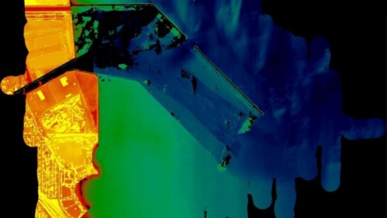
This pioneering start with continued innovation to meet client needs has enabled Optech to maintain its technology leadership in the industry, culminating in products such as CZMIL (image) for seamless topo/bathy even in turbid water conditions, the compact Orion for the highest quality and efficiency, the LMS automated workflow software for both airborne and mobile sensor data, and Lynx for capturing engineering-grade 3D data from vehicles moving at highway speeds.


