Optech to Present CZMIL Coastal Zone Mapping
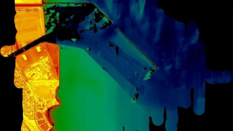
Optech, Canada, will be represented at the Oceanology International 2014 conference in London, UK, on 11 to 13 March 2014 at Stand G100, together with sister company Teledyne RESON. The company will be showcasing the results from the recent Optech CZMIL Coastal Zone Mapping and Imaging Lidar survey off Korea, where it demonstrated the accuracy, efficiency and turbid water capabilities that have made it indispensable for the ongoing coastal mapping operations of US government bodies and other customers.
Optech will also reveal the turbid and muddy water solution complementing Optech HydroFusion, CZMIL’s integrated software suite for planning surveys and processing RGB, hyperspectral and full-waveform Lidar data into fused 3D topo/bathy environmental products. Visitors to OI 2014 will be able to see the efficient and highly automated workflow that won CZMIL HydroFusion its own award, the recently announced MAPPS Geospatial Products and Services Excellence Award for Technology Innovation.
For users interested in an entry-level system able to collect bathymetric data in clear, shallow coastal waters, Optech will also demonstrate the capabilities of the Aquarius ALTM, a compact solution for collecting simultaneous land and depth measurements.
Finally, Optech will showcase the superior information content that resulted from fusing the 3D ILRIS data with the simultaneously collected RESON SeaBat multibeam echosounder data from the Costa Concordia disaster. The ILRIS Terrestrial Laser Scanner is known for accurately capturing 3D detail for bridge inspection, port infrastructure and emergency response from safe locations. Visitors to the stand will also learn about its new remote control, enhanced workflow efficiency and automated monitoring capabilities.


