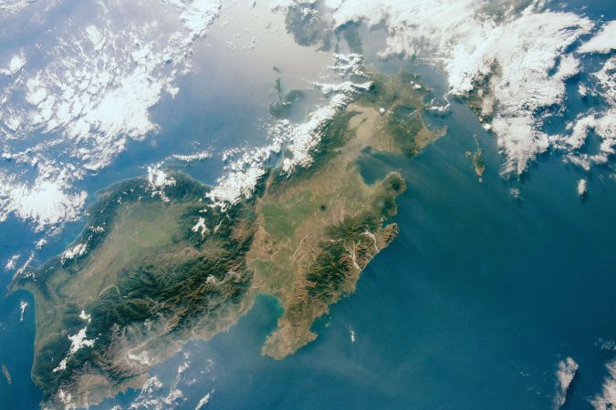
Philippines Joins Effort to Map Entire Ocean Floor
The Nippon Foundation-GEBCO Seabed 2030 Project has entered into a memorandum of understanding with the National Mapping and Resource Information Authority (NAMRIA) of the Philippines. The two parties will work together to further global understanding of ocean science.
As the country’s central mapping agency, NAMRIA – an attached agency of the Philippines’ Department of Environment and Natural Resources – is mandated to provide the public with mapmaking services and to act as the central mapping agency, depository and distribution facility for natural resources data in the form of maps, charts, texts and statistics. Through its Hydrography Branch, the agency conducts hydrographic surveys to analyse oceanographic data used primarily in navigation, research and marine management.
Geospatially Empowered Nation
In addition to its Hydrography Branch, NAMRIA also comprises other technical branches, including the Mapping and Geodesy Branch (MGB), Resource Data Analysis Branch (RDAB) and Geospatial Information System Management Branch (GISMB). MGB is in charge of national geodetic reference frame development and topographic base map production; RDAB manages land and coastal resource mapping, land classification and thematic mapping activities; and GISMB oversees the sharing and dissemination of data that helps to create essential base maps.
“We want to see the Philippines become a geospatially empowered nation,” commented NAMRIA Administrator, undersecretary Dr Peter N. Tiangco. “NAMRIA strives to become a centre of excellence not only in support of this national aspiration, but also to help progress the global effort, led by Seabed 2030, to expand our understanding of the ocean. We acknowledge the vital role a complete map of the ocean floor plays in helping us protect the planet – the blue planet – and we are delighted to join this endeavour,” he added.
Seabed 2030 project director Jamie McMichael-Phillips said: “Our partnership with NAMRIA is a significant development for the project. As a founding member of the Association of Southeast Asian Nations (ASEAN), the Philippines has become the first member state to sign up to Seabed 2030, demonstrating its commitment to developing our understanding of ocean science, and working towards Sustainable Development Goal 14: to conserve and sustainably use the oceans.
“We look forward to working with colleagues at NAMRIA to progress our goal of 100% of the ocean floor mapped by the end of the decade.”
All data collected and shared with the Seabed 2030 Project is included in the GEBCO global grid, which is free and publicly available.
Seabed 2030 is a collaborative project between The Nippon Foundation and GEBCO to inspire the complete mapping of the world's ocean by 2030, and to compile all bathymetric data into the freely available GEBCO Ocean Map. GEBCO is a joint programme of the International Hydrographic Organization (IHO) and the Intergovernmental Oceanographic Commission (IOC) and is the only organization with a mandate to map the entire ocean floor. Seabed 2030 is formally endorsed as a Decade Action of the UN Decade of Ocean Science for Sustainable Development.