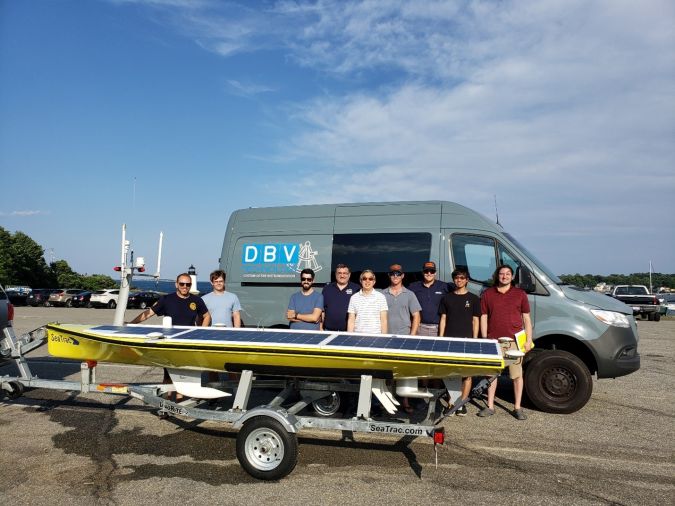
Princeton University Selects SeaTrac SP-48 to Monitor Deep Earthquake Rupture Sites
SeaTrac Systems has announced the sale and delivery of one of its SP-48 persistent uncrewed surface vehicles (USVs) to an elite geosciences team at Princeton University. Working with long-time collaborator Harold “Bud” Vincent and DBV Technology, Dr Frederik Simons and his Princeton team aim to advance the current state of the art for seafloor geodesy, which is the science of understanding the depth, shape and movement of the seafloor and how seafloor bathymetry relates to its gravitational and magnetic fields.
By combining acoustic data with GNSS data (GPS-A), the team’s specific interest is persistently monitoring deep seafloor tectonic plate movement to better measure its change and shape before and after earthquakes.
Seafloor Geodesy at Scale
The Princeton geophysicists, using DBV’s innovative system and method for seafloor geodesy, employ either temporary or continuous deep ocean geodetic sensors (T-DOGS or C-DOGS). These measure seafloor tectonic plate movement at any ocean depth, using very low power and for very long-term deployments more accurately and economically than present methods. T-DOGS are recoverable and are for deployments up to three years, while C-DOGS are for 30 to 50 years and are not intended to be recovered. SeaTrac’s SP-48 autonomous platform will transit desired acoustic survey data paths for up to 12 hours at a time, loiter over the DOGS to receive their telemetered data, and regularly send the data to shore via satellite. Test missions are planned initially for Puerto Rico in the fall of 2022 and Bermuda in spring 2023.
“This is a critical technology to enable seafloor geodesy at scale, and the overall success of the mission is highly dependent on how the USV performs,” notes project technical lead Bud Vincent. “There are a huge number of USVs out there. We looked at all of their capabilities and maturities; from an economic and technical standpoint, SeaTrac’s stood out.”
“Oceanographic research is more critical than ever and environmentally and economically we can’t justify or afford to keep crewed ships at sea for months on end. Seafloor geodesy at scale is a perfect example of how autonomy can make long-term data collecting sustainable in every sense of the word,” notes SeaTrac’s director of product & business development Hobie Boeschenstein.