Seabed 2030: Almost 25% of World’s Seafloor Now Mapped
The most prominent international effort to chart the world’s entire ocean floor, The Nippon Foundation-GEBCO Seabed 2030 Project, has seen a significant increase in ocean data equating to the size of Europe this year.
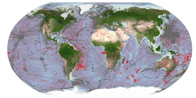
The latest GEBCO Grid figure now stands at 23.4%, reflecting an increase of 10.1 million square kilometres of new bathymetric data compared with last year’s figure. This increase is equivalent to an area around the size of Europe, and slightly larger than the Sahara – Earth’s largest hot desert.
The Necessity of a Complete Map of the Seabed
The latest figure was announced recently by Mitsuyuki Unno, executive director of The Nippon Foundation. Unno said: “In just five years, Seabed 2030 has led the way in ocean mapping to achieve 23.4% of the seafloor mapped to a high resolution.
“Despite covering over 70% of the planet, our knowledge of what lies beneath the blue surface has been severely limited. Without this crucial information we cannot possibly set about having a sustainable future – a complete map of the ocean floor is the missing tool that will enable us to tackle some of the most pressing environmental challenges of our time, including climate change and marine pollution. It will enable us to safeguard the planet’s future.”
A complete map of the seabed is needed for a host of reasons, not least for the future of humanity. The ocean drives global systems that make Earth habitable for us – oxygen, drinking water, much of our food and the climate are ultimately regulated and provided by the sea. Ocean floor topography also helps identify underwater hazards and inform sustainable marine resource management and infrastructure development.
Seabed 2030 Project Director Jamie McMichael-Phillips welcomed the data increase: “It is encouraging to see this growth in bathymetric data despite the challenges facing ocean mapping, which were undeniably exacerbated by the pandemic.
“As we make headway with the Ocean Decade, we look forward to accelerating our efforts to recoup time and effort lost last year. The progress we have made since 2017 is commendable, but we are mindful of the task still ahead – and eager to realize it.”
Ocean Decade
The Ocean Decade – of which Seabed 2030 is a flagship programme – is a major initiative by the UN to mobilize governments, the private sector, scientists and civil society to co-design and co-deliver transformative knowledge-led actions to reverse the decline in the health of the ocean and make a change in the sustainable management of the marine environment. IOC-UNESCO is the UN body tasked with leading the implementation of the Ocean Decade.
“The Ocean Decade is about closing the persistent knowledge gaps we face in the ocean community once and for all, because we cannot manage what we cannot measure. Mapping the seafloor is at the basis, at the root, of this effort. The sine qua non for creating fail-safe, inclusive and protective mechanisms for sustainable cohabitation between society and nature within the deep ocean – our last frontier,” commented Ariel Troisi, chair of IOC-UNESCO.
Seabed 2030 recently also announced a major new partnership with the United States’ National Oceanic and Atmospheric Administration (NOAA). Seabed 2030 actively seeks partnerships to collate all existing data into the definitive GEBCO map and to identify areas where there is no data to inform future mapping expeditions.
NOAA’s mission is to understand and predict our changing environment, from the deep sea to outer space, and to manage and conserve U.S. coastal and marine resources. The agency is part of the U.S. Department of Commerce, and holds key leadership roles in shaping international ocean, fisheries, climate, space and weather policies.
Signed by Seabed 2030 Head of Partnerships Stephen Hall and Rick Spinrad on behalf of NOAA, the Memorandum of Understanding (MOU) formalizes collaboration that has already begun between the two parties. It will also greatly expand our understanding of the world's ocean.
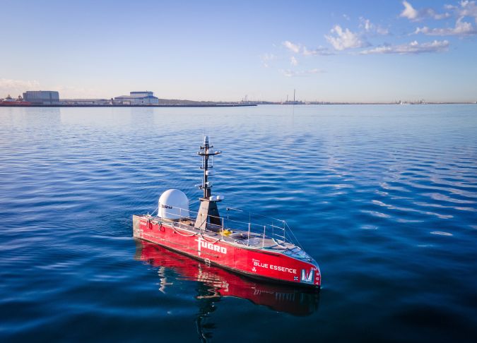
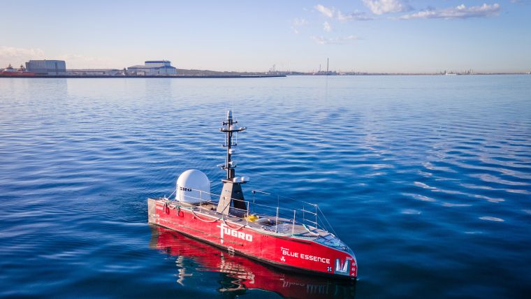
New Tools and Technologies for Mapping the Ocean Floor
Spinrad’s involvement with NOAA dates back to 2003, when he served as head of its National Ocean Service for two years, and head of its Office of Oceanic and Atmospheric Research for seven years. He was chief scientist from 2014 to 2016, before being nominated by U.S. President Joseph Biden last year to serve as the under secretary of commerce for oceans and atmosphere, which includes serving as the administrator of NOAA.
“The ocean covers more than 70% of the planet,” said Spinrad. “With the development of new tools and technologies for mapping and measuring its floor, we have a better capacity to understand its physical structure and the life it supports, and therefore better understand our full planet. That knowledge can help us make better, more sustainable decisions – locally, nationally and globally.”
Stephen Hall said: “We are delighted to announce our latest partnership with NOAA. The expertise offered by this well-established institution and its scientists will play an invaluable role in taking us one step closer to the finish line. We intend to hit the ground running with the time remaining and signing this significant MOU at our event here in Lisbon is a testament to exactly that. Every minute counts.”
All data collected and shared with the Seabed 2030 Project is included in the freely available GEBCO global grid – the most complete bathymetric dataset of the world’s ocean floor.
Seabed 2030 is a collaborative project between The Nippon Foundation and the General Bathymetric Chart of the Oceans (GEBCO) to inspire the complete mapping of the world’s ocean by 2030, and to compile all bathymetric data into the freely available GEBCO Ocean Map. GEBCO is a joint programme of the International Hydrographic Organization (IHO) and the Intergovernmental Oceanographic Commission of UNESCO (IOC-UNESCO), and is the only initiative with a mandate to map the entire ocean floor.