Seabed 2030 Project Announces Partnership with TCarta
As the effort in pursuit of the complete map of the ocean floor accelerates, The Nippon Foundation-GEBCO Seabed 2030 Project has signed a new Memorandum of Understanding (MOU) with TCarta Marine – a US-based company dedicated to marine remote sensing and hydrospatial data services.
Seabed 2030 is a collaborative project between The Nippon Foundation and GEBCO to inspire the complete mapping of the world’s ocean by 2030, and to compile all bathymetric data into the freely available GEBCO Ocean Map. GEBCO is a joint project of the International Hydrographic Organization (IHO) and the Intergovernmental Oceanographic Commission (IOC) and is the only organization with a mandate to map the entire ocean floor. Seabed 2030 is formally endorsed as a Decade Action of the UN Decade of Ocean Science for Sustainable Development.
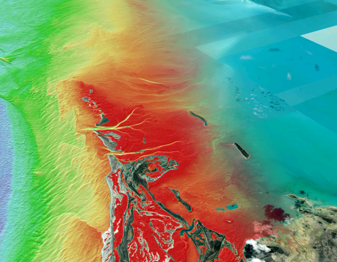
TCarta has been a global innovator in Satellite-derived Bathymetry (SDB), marine remote sensing and space-based hydrospatial technologies since its founding in 2014. The company has extensive experience producing custom, project-specific SDB, as well as en masse through automation and cloud computation.
Satellite-based Surveying Technology
Funded by the National Oceanic and Atmospheric Administration (NOAA), TCarta is currently pursuing advancements in on-platform parameterization of satellite imagery collection for improved SDB data, as well as the development of SDB standards, next-generation assessments of data accuracy, and definitions of zones of confidence.
“With just over 20% of the seafloor mapped, we are aware of the significant task ahead of us – mapping the remaining 80% of the seafloor in under ten years,” commented Jamie McMichael-Phillips, project director of Seabed 2030. “However, at Seabed 2030 we subscribe to the view that with global cooperation, producing a complete map of the entire seafloor within our timeframe is achievable. We are therefore delighted to welcome the support of TCarta in helping us realize our goal.”
Commenting on the partnership, president of TCarta Kyle Goodrich said: “At TCarta, we recognize the need for a complete map of the seafloor and especially in vulnerable and dynamic coastal areas.
“We are very excited to bring TCarta’s vision for scalable, global satellite-based surveying technology, developed under our National Science Foundation Small Business Innovation Research grant, to participate in this important global initiative. TCarta looks forward to this partnership in striving for Seabed 2030 goals by contributing bathymetric data to in-fill the data gaps in existing hydrographic survey coverage.”
All data collected and shared with the Seabed 2030 Project is included in the GEBCO global grid, which is free and publicly available.