Sedimentation Monitored in Yellow River Dam
The sediment levels in the Xiaolangdi dam (Yellow River, China) are being monitored using a GeoSwath wide swath bathymetry sonar.
The Yellow River (Huang He in Chinese) runs for over 5,400km. After leaving Inner Mongolia it passes through the extensive Loess Plateau, picking up an annual silt load of up to 3.91 billion tonnes. This makes it the most sediment-laden river in the world. The Xiaolangdi Dam is located 40km north of the ancient city of Luoyang (Henan Province) at the lower end of the middle reaches of the river. Xiaolangdi is a multi-purpose project for flood prevention, ice control, fresh water supply and hydroelectric power. It supplies 5.1 billion kWh of electricity a year, enough to support several local cities. The project is the largest of its kind on the Yellow River, and in China is second only to the Three Gorges project on the Yangtze.
Following the completion of the 154m high dam in 2001 a reservoir covering 272 square kilometres was filled. The river's sediment load leads to rapid siltation and requires regular controlled opening of the dam floodgates.
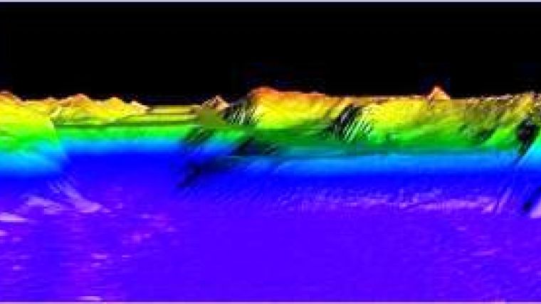
Accurate maps of the water depths in the dam are regularly made using a GeoSwath deployed on a small survey launch. The full coverage bathymetry allows the sediment deposition to be closely monitored, enabling clearing operations to be planned more efficiently and safely. Over 10,000 tourists come each year to see the gates opened and the accumulated sediment flushed out.


