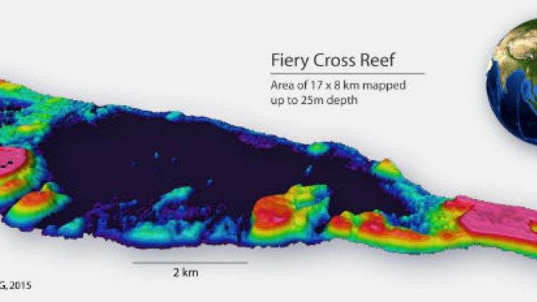
Shallow Water Bathymetry for South China Sea
EOMAP Asia Pacific has launched a detailed dataset for the islands in the South China Sea, generated by satellite-derived bathymetry (SDB) techniques. The islands of the South China Sea are several hundred kilometres away from the nearest coast and are surrounded by water deeper than 1,000m, which is assumed to hold extensive oil and gas reserves. The area is a disputed territory of several countries within the Asian region. Data about the underwater topography is outdated or not accessible.
Instead of relying on acoustic or airborne methods to map the over 250 islands, atolls, cays, shoals, reefs and sandbanks, EOMAP used satellite image technologies, a rapid and cost-effective solution. With EOMAP having mapped the Great Barrier Reef of Australia, the Mexican Riviera Maya and the Persian Gulf this is the next big step towards an increasing and updated bathymetric database, which is offered to commercial and governmental clients both alike.
A.S. Mittal, CEO of EOMAP Asia Pacific, commented that these techniques from satellites allow these islands to be mapped from space and provide options for continuous mapping at regular intervals. EOMAP will continue to monitor these areas for changes and provide detailed reports to anyone who subscribes to its monitoring services.
The data is available in a 15m bathymetric grid and on request in a 2m or even sub-metre grid using the most recent satellite imagery. Thanks to the clear water conditions of the South China Sea, water depths of up to the 25m contour line could be mapped. This is actually the depth range which is of particular importance for navigation.


